
Thursday, June 6th, 2024
Distance ridden 383 kilometres
I woke up some time before dawn and knew, at once, that I would not be able to go back to sleep. Some of the windows in our corner room (and all of the windows in the shower …) faced eastwards and it was not long before the first grey streaks of dawn appeared on the horizon.
I was aware that it was June 6th and, in 1944, exactly eighty years previously, that had been D-Day, when the allied forces stormed the beaches of Normandy which ultimately brought the downfall of the Third Reich. It seemed a little strange to be in a German speaking environment at such a moment. I stood on the terrace watching the light slowly grow and wondered what had gone through the minds of those brave souls bobbing in landing craft in the swell off of the coast of Normandy when that same thing had happened to them. Without being cheesy, we should never forget what they did for us. Everything that we have, we basically owe to them and I find it distressing that so many of the, so called, “celebrities” that pontificate in our media have no idea, at all, of when the Second World War was fought, let alone who the combatants were. End of sermon.
Breakfast was helpfully available from 06:30 – and we were there when they started serving. I think we were both keen to make the final hop to our little apartment.
Another good thing about Austria is their great breakfasts. I managed chocolate (!) cornflakes and was able to make bacon (they call it spek) sandwiches to go with my egg, which set me up a treat for the day. Lucie always takes a more “continental” route, with things like yogurt and honey, but then, for all her admirable qualities, she is not English. Of course, I did manage to somehow jam open the valve of the hot-water urn, when I made my tea. The unflappable breakfast lady fixed it and soaked up the sea of hot water as if she had done it a hundred times. Given the ease with which the valve jammed, maybe she had.
We packed, loaded the bike and were on the road before 07:30. We would soon be home, or so we thought …..
I always say that, with a SatNav, even if you have absolutely no idea where you are, you are not actually lost. In truth, it will ALWAYS find a way to get you where you tell it want to go – it is just that sometimes, the route it selects is a bit weird. One thing it seems to get confused with is the difference between “shortest” and “fastest” and seems to assume that the former is always the latter – this is not so. Also, it seems practically to be able to measure to the centimetre which means that a diversion (the dreaded “UMLEITUNG”) that takes you way from its choice, immediately leads to a recalculation that can change things entirely. Make no mistake, our little SatNav is a wonderful tool – but now it decided to play games with us …
I had downloaded all the latest updates before we left home, but have to assume that, for example, in the area between Salzburg and Passau, there had been road changes of which it was unaware.
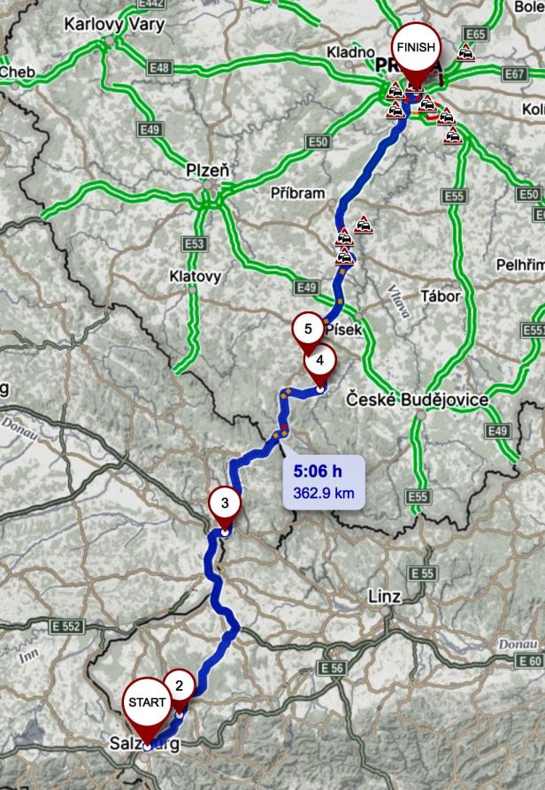
When we left the Gasthof, it was so quiet, it was hard to believe we were on the fringes of a major city. It was a great place to stay, very handy for the motorway, particularly of you are “just passin’ thru” as they say, which is what we tend to do. Gasthof Der Jägerwirt (Kasern 4, 5101 Salzburg).

The motorway was only a couple of kilometres away but, no sooner had we left the Gasthof than, for some reason, the SatNav was slow to react – and I missed our turn onto the slip road. That was not a great problem, but it did mean making a circle and spending ten minutes in the rush-hour traffic of Salzburg that could have been spent in the fast lane.
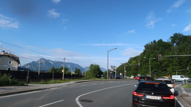
Then, as expected, the SatNav led us off of the motorway to head northwest into the countryside to cut off a long loop of highway. The countryside around Salzburg is so grand that it always takes my breath away.
The move made sense, it has done it before, but, this time, it seemed to be behind with the most recent road developments. This meant that I missed a turning I should have taken (I guessed it when the road went from busy to deserted) in the town of Mattighofen. The SatNav tried to correct itself by taking us through the tiny streets of a cutesie housing estate. Back to where it (and we) thought we ought to be to return to the correct route, it was again slow to react and I went right instead of left …. Easily corrected, we reversed direction and, as I slowed to allow an articulated lorry to articulate around a tight roundabout, a Volkswagen ran into us from behind. Do not panic on our behalf, it was a fairly gentle bump onto our sturdy rear mudguard and light cluster – nothing broken and we did not go down on the floor. It was fairly alarming though and the unfortunate driver, a perfect Austrian gentleman, seemed positively distraught. Still no harm done.
We came to the route we wanted, but the SatNav seemed to disagree. We obviously needed to go left, but it took us right, along a road, around a roundabout and back past where we had joined… This was, presumably, because there was a solid white line in the centre of the road that it did not think we should cross …….
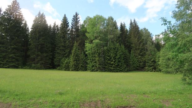
By that time, we had no idea where we were or in what direction we were heading, so I decided to trust it and just go with it. For all the reasons above, we wended a curious route across some truly lovely, but remorselessly “Germanic” countryside. As I always say, “even the weeds were growing in straight lines”. It is true, though, that the rural areas in Austria and Germany are always VERY well kept. Riding in the sunshine, with the visors up, the scents of the countryside and forests were overwhelming.


Eventually, we did come to the motorway again, this time the A8 – which morphed into the German autobahn 3 when we crossed the border – at which security checks were in place. There were still more roadworks, the whole system appears plagued with them – and it was again slow progress.
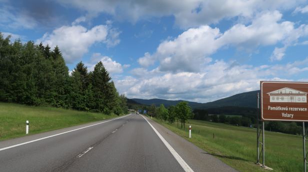
We left the highway and turned towards Passau, for the ride home via the picturesque Šumava – and straight into yet more difficulties ……..
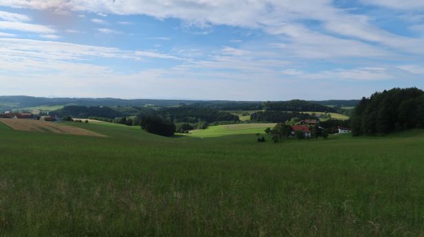
We had heard vague rumours about a bit of flooding in Bavaria, which inevitably raises the level of the Danube, which runs through Passau. When we crossed the river Inn, which along with the much smaller river, the Ilz, joins the Danube in Passau, it was noticeably high and, in some places, over its banks. In Passau town itself, I would hesitate to say there was devastation, they are fairly used to inundations and I have seen it worse. However, the river level was well over the banks in a lot of places and yet more diversions were in place to guide us through the city without needing to ride in water.


Once across the Danube, the road climbs quite swiftly. We passed beneath one of our favourite restaurants, Das Oberhaus (Oberhaus 1, 94034 Passau) perched high on a bluff above the confluence of the Ilz and the Danube, sadly, no meal overlooking the city on that occasion. We set off, uphill, on Route 12 and thought we were, more or less, home and dry. But, of course, it was one of those days.
Germany, particularly so close to the border, is not much different from the Czech Republic – just a bit more orderly …..

 We passed easily through the border, although there was a manned post in which an official was, at least, scrutinising the vehicles coming the other way and moved seamlessly onto our “home turf“. The road through Šumava was as green and picturesque as always.

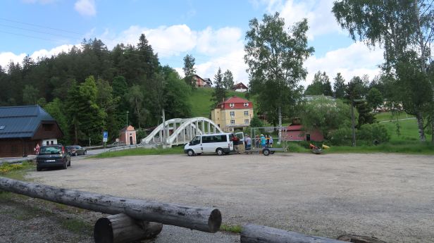
Just before the town of Horní Vltavice, we drove over the sweet little bridge that spans one of the two rivers that eventually become the Vltava in Prague. This branch is the Teplá (warm) Vltava.
Lucie wanted to stop for a coffee in the small town of Kubova Huť where the sudden installation of widely spaced average speed cameras, post-Covid, coupled with the glacial speed of the Penalty notifications, cost me quite a bit of my hard earned cash. I am a cautious driver, but you only get a 3 kph “allowance” and it seems it is pretty easy to do over 54 kph …. Lucie humorously thought that stopping in the middle of the two cameras for half an hour might convince those grasping eyes that we had been beamed up to our mother ship.

Of course, despite everything, it was still too early for her chosen place to be open. We moved on, still cautiously, because many other small hamlets on that stretch of road (Route 4) have followed the example of Kubova Huť and installed money-grabbing surveillance devices. Yes, I am grouchy about this, it is a fabulous road and there is, in most places, no “safety” justification for the cameras, it is just a money-spinner for the Vimperk district !
At this point, the battery in the camera ran out, so there are no more picture. Under the circumstances, that may be just as well.
We came to the centre of evil, sorry I mean the town of Vimperk, itself and, because I know there are yet more speed cameras on the very steep hill down into the town, I slowed to exactly 50 kph. This did not suit the Audi driver behind me, so he pulled around us and surged ahead. In the distance I am sure I heard the “Kerching !” of the Municipality’s cash register !
From good old Google ™, Lucie had located a place that was open, so we went to Café Mráz (Pražská 206, Vimperk). What a great little place and situated right beside the Route 4 through town. We sat on a sunny terrace. Lucie’s espresso was good, but my hot chocolate seemed to be just that …. Thick, dark and with cream on top, it was so good I almost did not want to drink it, because, if I did, it would be gone ! Lucie’s sticky cake and my brownie were equally good. If you are ever in Vimperk, drive slowly and go to Café Mráz !
Perked up by the sugar (which meant I was really perked), we set off on what we both assumed would be the last leg of our trip. Well we know what assume does, do we not ?
Still in Vimperk, there was a sign in the middle of Route 4 stating that the road ahead was closed and a “diversion” was signposted. At least, it was signposted there ….. We set off, I did not really mind as I quite like driving on roads where I have not been and this qualified.
It started well, occasional arrows indicating we were on the right way, then there was a big stretch without any – and then one pointing to a road on the left. So I took it. This produced some intercom jabber as Lucie was scanning her Czech map program and was sure this was wrong – but what could I do ? We rolled through some nice countryside whose endless, rural. greenery was totally unsullied by orange ”diversion” arrows – and ended up back on Route 4 about five kilometres from where we had left it –TWENTY TWO kilometres before …
At the turn, there was no signs at all suggesting anything was amiss and no suggestions the road might be blocked. So, off we went in the direction of Strakonice. Sometimes, the charge in our intercom runs out – some times it just keeps working, which, unfortunately was what it did then …..
It did, eventually turn out that the road was closed, but right on the outskirts of Strakonice. A quick detour up an adjacent road and through a couple of villages put us onto a fairly major road leading into the town. I mentally prayed that this was NOT the one I had turned off of – and, luckily for my ears, it was not.
From Strakonice, it was merely a continuation of our time on Route 4 and about an hour to home. The roadworks, that are bent on turning the stretch between Prague and the Strakonice turn-off into a proper motorway, were still in full swing and it appeared that they might finally be getting somewhere. There were spells on new four-lane blacktop, but still a lot sections where it was down to just a couple of narrow lanes.
Because of the extra time everything had taken, we made one final stop for espresso and a smoke when we were diverted into the small town of Milín. Small the town may be, but it was in the area between Milín, Slivice and Čimelice, where the final land engagement of World War II in Europe took place. In what is known, historically, as the Battle of Slivice, an SS tank regiment, attempting to flee west and surrender to the (more forgiving) Americans, took on some Russian tanks and local partisans on the 11th and 12th of May, 1945. The Germans were eventually forced to surrender and 6,000 of them entered Soviet captivity. The event is commemorated by a memorial, the Památník Vítězství, on a hill in Milín. The impressive columns were clearly visible from the old Route 4. but whether that will remain so, once the new motorway opens, we can only wait to find out.
The diversion deposited us back onto the old motorway section of Route 4 and it was a fairly short ride of around sixty kilometres to outside of our front door. It had been a longer than expected day and we both were, I think, actually pleased to be dragging our bags up the one hundred or so steps to our flat.
Hardly had we sat down, before some quite torrential rain was drumming on our windows. Maybe good luck won out in the end after all.
