
Sunday, May 21st, 2006 – Distance Travelled 354 Miles

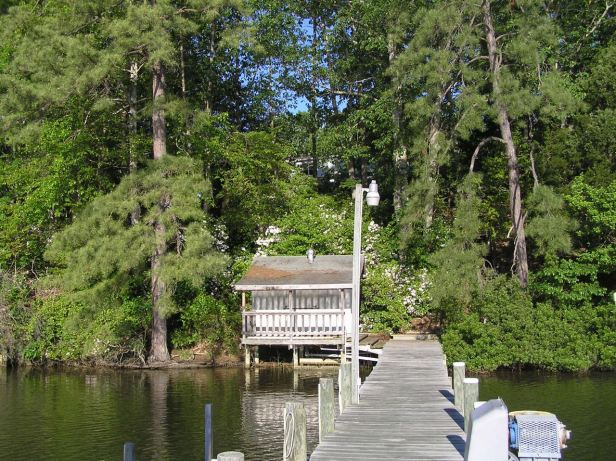
We had agreed an early departure for our next set of “sights”, but I woke up about an hour before the set 07:00 “sharp” leaving time. The huge house had its own dock and I walked to the water’s edge where the Rappahannock lay still and scarcely moving. It was quiet enough to hear a pin drop.

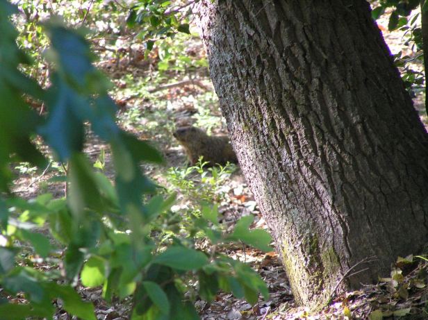
I saw a turtle (or possibly a terrapin at the edge of the water and then there was a slight rustling in the undergrowth. A large furry rodent, that I now know to be a groundhog, appeared briefly before sensing me and vanishing completely.

I returned to the house to find my friend had prepared what I can only call a “healthy” breakfast ! I had almost forgotten what fruit looked like, but the prepared mixture was a delicious as it was extensive in that typical American way. A couple of coffees and we were off, purring through the private estate to the Routes 354, 201 and finally the Route 3 before heading north-west.
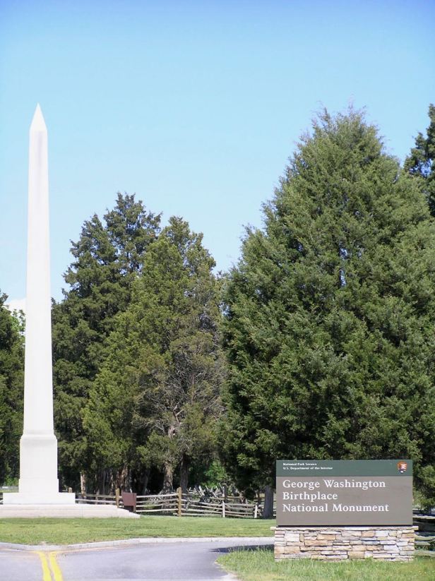
Our destination was the town of Fredericksburg which was the site of the biggest single battle of the Civil War and close by to three others. As we headed up Route 3, however, my friend directed me to make a right turn onto Route 204. After a few miles, we came to the plantation where George Washington had been born, the George Washington Birthplace National Monument (Colonial Beach, VA 22443). It was a beautifully rural location, probably missing a cherry tree somewhere. It was still too early for it to be open, so we quickly snapped the obelisk and moved on.
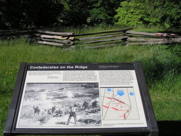
We carried on to Fredericksburg and, as we entered the town, Route 3 was billed as “The Blue and Gray Highway” as a homage to what took place there. In mid-December, 1862, Union troops under General Burnside managed to bridge the Rappahannock with pontoons despite being under constant artillery and rifle fire. Return artillery fire from Union forces almost completely destroyed the town. Having crossed, the 120,000 Union troops first looted the ruins and were then ordered to assault the Confederates on the Maryse Heights above the town. On December 13, 1862, General Burnside thought he would surprise the Confederates by attacking them head-on up the slope. Although the Confederates were heavily outnumbered, they had less than 85,000 troops, they were very ready for the frontal attack and the Union soldiers were mowed down by Confederate fire. By the end of the day the Union had suffered so many losses (12,653), they were forced to retreat. Confederate losses were 5,377. No doubt prepared by a Southerner, the informative signs reports almost gleefully that the battle signalled the low-point of the war for the Union. General Burnside was relieved of his command shortly afterwards and the signs also quote Robert E. Lee as saying “It is well that war is so terrible, or we should grow too fond of it.“.

With the knowledge of hindsight, battlefields affect me. Sitting on a wall, behind which the Confederates were entrenched and looking down the steep hill towards the Rappahannock, it was all too easy to imagine the hopeless bravery and the terrible carnage that had taken place just below where I sat. I think we both felt a little down from the futility of it all so we decided that we would give the remaining three Civil War sites nearby, Spotsylvania Courthouse, the Wilderness and Chancellorsville, a miss.


So, we set off south, avoiding the I-95 by resorting to the slower, but more picturesque, Route 301. We skirted Richmond, as I had the day before on the I-295 and again ignored another battlefield, at Mechanicsville, before heading east on Route 60, dubbed “The Pocahontas Trail”. We were on a sort of “Magical Mystery Tour” and I had not been informed of our destination, but I do know my history, so I correctly guessed we were heading to Jamestown. We followed the Route 60 as far as Williamsburg where, following the signs (America is so very good at its signage) we located Route 21 and indeed soon arrived at Jamestown.
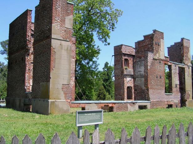
Jamestowne, as it then was, is now in ruins but it was the first permanent English settlement in North America. Nearby, the Jamestown Settlement is a living-history museum with a reconstructed 1610 fort and a Powhatan Indian village.
There is a statue of the Indian maiden (this was in 2006, remember) Pocahontas, whose name has since become synonymous with almost ANY native American girl. Pocahontas married a settler called John Rolfe and even visited England and was presented at Court.


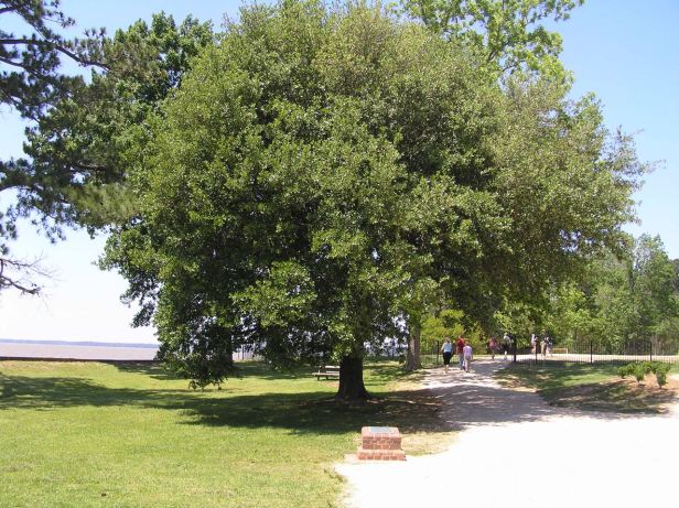
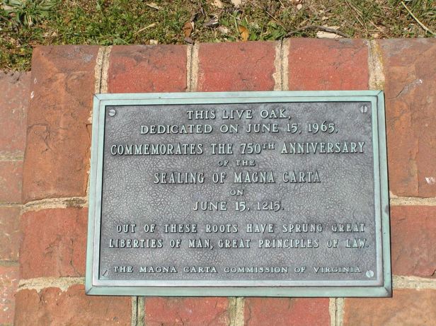
Curiously, there was also an impressive Oak tree, planted on June 15th, 1965, to commemorate the 750th anniversary of the signing of the Magna Carta in England.
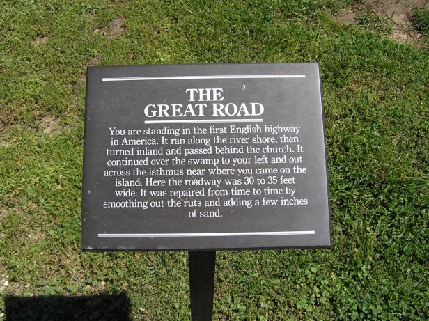
Finally, there was a section of the first proper road constructed in America, which went through some still impressive gates.

It was interesting, but a fraction overdone. It is a very popular site because a large number of Americans like to believe they are descended from Pocahontas and John Rolfe. We moved on.
We left the way we came in, but in Williamsburg we took Route 199 until we came to our old friend, Route 60 and turned south. We stayed on that road until we came to the very long James River bridge, where we switched to Route 17. This led us through green countryside and over three more impressive bridges until we finally arrived in the huge complex of residential areas and Navy bases that is Norfolk. I had not been informed about our destination, we had a method of touches on the shoulder to navigate me, so, although I knew my friend to be a “Navy Man” and this was DEFINITELY a navy town, I had no idea why we were there.
We crossed two more, far smaller, bridges and rode along the waterfront. I was instructed to stop and, right in front of me was a huge battleship and I do mean huge. It was so long, it looked more like a small town than a seagoing vessel.


This behemoth was the USS Wisconsin (1 Waterside Dr, Norfolk, VA 23510). My friend told me this was the ship his father had served on in the Second World War. It was an impressive sight. We did not go aboard because refitting work was going on, but sat on a bench in the sunshine while my friend talked about it. If anyone cares, it was the second “Iowa” class vessel built out of a total of four and served in the Pacific war in the Philippines, Iwo Jima, Okinawa and actually bombarded Japan itself. Later it served in both the Korean War and was brought back from “mothballs” to fight in Operation Desert Storm. It is now a museum and permanently owned by the City of Norfolk.

It was, by then, well after lunchtime and I was then told I would be getting a “treat”. We rode the short distance to the Monastery Restaurant (443 Granby St, Norfolk, VA 23510), which specialised in CZECH cuisine !!! I love my friend, but I suspected this might actually be more of a treat for him than for me, as I knew he missed Prague. It was surprisingly authentic. Its owners had taken advantage of the brief loosening of restrictions in 1968 to flee their homeland and were genuinely pleased that I was from there. Their Czech was as rusty as mine was poor. Although we could all have talked in English, I actually had one of the longest conversations, in Czech, that I have ever had. We both had the traditional Czech dish, svíčková na smetaně (beef with dumplings, cream and cranberries) and palačinky (pancakes). They even served the Czech beer, Pilsner Urquell and my friend had two. Strangely, as a “real” Pilsner (made differently from usual lagers), it has a high sugar content, so I just do not like it because it makes my head ache. I contented myself with mineral water using the excuse that I was driving. That did not save me however, from sharing a celebratory shot of Slivovice, the Czech plum brandy, with the owners, who somehow managed to conjure up a bottle. Luckily, it was a proprietary brand and not home-made. My Czech mother-in-law’s version of the same drink would fuel an aircraft !
We rode north out of town on the I-64. To cross the very mouth of the James River into Hampton, we started on yet another very impressive bridge which then dipped into a tunnel. The whole area is a huge naval installation and, it was calculated, having a bridge, which could be destroyed by enemy activity (or even a natural disaster), could lead to naval operations being compromised. Indeed many large navy ships were moored in what is called “Hampton Roads”, which was to our left and other vessels could be seen out in the vastness of the Chesapeake Bay, which was to our right. The North Atlantic was visible in the distance. Sea to shining sea, tick !
The I-64 paralleled Route 60, our way into town, for some time, but then a tap on my shoulder led me to Route 105 and another tap to Route 17. This took us to Yorktown where, in September 1781, British forces under Lord Cornwallis surrendered to the Americans under George Washington. This event effectively ended the War of Independence and allowed America to become what it is today. I am still sulking about that, so we did not stop. We crossed the York River on yet another splendid bridge and continued on the Route 17 to Gloucester. So many of the town names in that part of the world are English that it is a bit like driving at home. The only problem, as I have mentioned previously, is that they a distributed differently. In Gloucester we switched to Route 14, which took us due north to James Store where we encountered our old friend, Route 3, which I knew would take us back to Lively,
Yet another bridge carried us across the comically (to my ears, at least) named Piankatank River and, in light which was starting to fade, we rode through some slightly windswept countryside before our final bridge of the day over the Rappahannock and back onto the Northern Neck. It occurred to me that I was becoming a little bit used to such spectacular views. Lovely as it was, the view from the bridge hardly attracted my notice.
The “confusing” juxtaposing of the towns continued and it took us only a few moments to make the transit from Kilmarnock into Lancaster and we came to Lively in full darkness. The moon which had so delighted me in California was totally absent now and that experience was already beginning to seem like something from a previous life. The “Lively Drugs” sign was still gleaming redly in the dark as we made our way cautiously down the small, largely unlit, roads to Mollusk and the edge of the water. We sat for a while, with a couple of beers, on the dock. It was almost indescribably peaceful, but the bugs were slightly troublesome. Then we retired to our rooms. In the morning, I would be on my way again and I fell asleep dreaming of the way ahead.
