
Thursday, January 26th, 2023
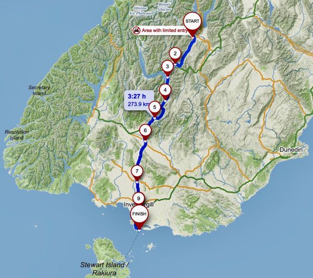
Distance travelled 309 kilometres .
In the morning we were in no particular hurry. To have time in some places to see all the things we wanted to see, it was easier to do some quite short “hops”. for this reason, we only had some 240 kilometres ahead of us to our lodgings in Invercargill. It was a beautiful, warm morning as we set off down the hill towards the glittering lake. We rode along the shore, took a last look at “that tree” and then turned south in the direction of Queenstown.
We drove the first part of the trip on the relatively newly opened scenic road over the summit of the Crown Range.

After the gravel trauma on the North Island, Lucie tried to check with the hotel reception as to whether the road was sealed all the way. Sadly, the guy who was on duty did not even seem to know there was a road leading there over the mountain at all (there is a shorter, flatter way too). I was pretty confident, so we took a chance and it paid off.
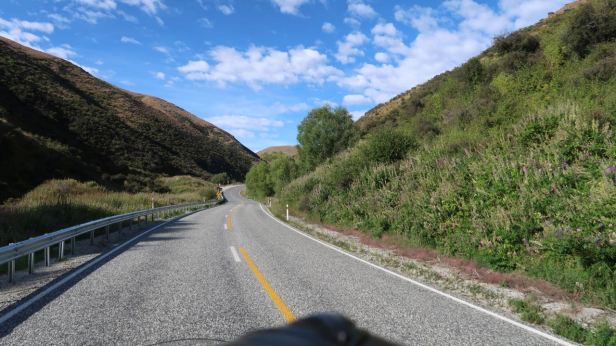
At first, the road led slowly, but progressively uphill. There was no sign of what was to come except for warning notices prohibiting transit by the really heavy lorries and suggestions, to those towing caravans, that this might be an inadvisable route. We climbed continuously, but relatively gradually, until just before the top, where a really steep climb began. Even at our low speed, for once no one overtook us, because the incline slowed everybody down to practically walking pace.
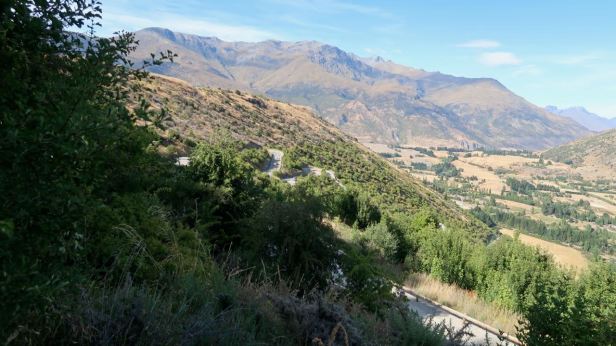
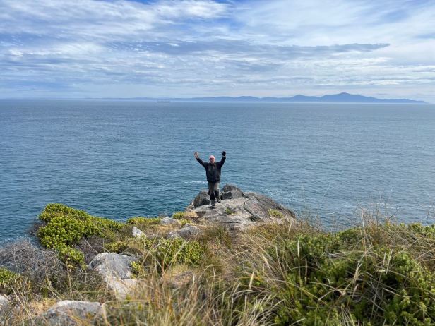
At the summit, marked as being 1076 metres above sea level, there was a viewpoint.

The view ahead that it presented was stunning and very extensive from that elevation.


There was also a cairn commemorating the completion of the “sealing” of the road in the year 2000. It had been in use, unsealed, for over a century prior to that. Apparently, in the late 19th century, people used to (somehow) make the trip in horse drawn carriages …..

Before the ride down, I pointed out the winding and steeply descending road to Lucie and told her it could be a bit “hairy“. She, of course, has studied the map and told me that the worst bit was after what we could see from where we were. There would be a series of real hairpins, but there also would be a place from where we could look at them, before the final part of the descent. Down we went. The road was very steep and the corners quite tight, but rolling against the compression in third gear made them all perfectly manageable. Nobody caught us up and it was not too bad at all.
Then we came to the lookout promised by Lucie. Again, I could see for a very long way into the distance, but not the road directly below us because vegetation blocked out most of the view. Fleeting glimpses of the “ZigZag” hairpins was all I could see.
Cautiously, we continued on down. The way was a series of straights between murderously tight, hairpin bends. Not a place to fall off, but again, when rolling against the Harley’s compression, not over concerning. High concentration was, of course required at all times and some of the corners took a lot of wrestling to get the heavy bike around, but then it was done.


Like most things, in retrospect, I realised that I had actually enjoyed the scary descent. The road surface was mainly pretty good, but there were a few big bumps. One of these I hit, because a vehicle ascending made it unavoidable. Sadly, this caused me to bite my tongue to the extent that it was still bleeding over 200 kilometres later. Still, what is a day without a bit of (my) blood ?
The plan included a stop at a café that was shown on the maps as being below the hill. But with a new road layout (our little blue arrow on the SatNav showed no roundabouts- and they were definitely there !) we never found it. Thus, not being in New Zealand for the adventure sports mecca of Queenstown, we carried on south leaving the town and the traffic heading there behind us.
I did go to Queenstown on a visit to New Zealand in 2020 and, amongst other crazy things, I did make the then highest land-based bungee jump in the world, the “Pipeline”. However, as they say “that was then ….”.
The “now”, that morning, involved a scenic drive along the eastern shores of Lake Wakatipu, on which Queenstown is located at its northernmost point. We stopped at a beautifully maintained viewpoint where a sign declared that the land upon which we were standing had been donated to the public by some wealthy patron.


When we stopped there, we were the only vehicle, but gradually one car after another started to drive down there and park. Their passengers were getting ready to have breakfast in nature. This reminded us that we had not had breakfast yet ourselves and we set out to find an open café.
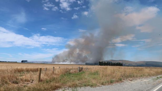
All over New Zealand, we had often passed signs indicating the likelihood of fire. In the South Island, the farther south we got, the more the signs indicated extreme caution. As we went along, I noticed smoke in the distance. This was a bit concerning because, on my visit in the year 2000, wild fires on the South Island had caused many road closures and there were not exactly many options. When we got nearer, it seemed that (thankfully), although it was a really huge fire, it was some kind of controlled burn ……
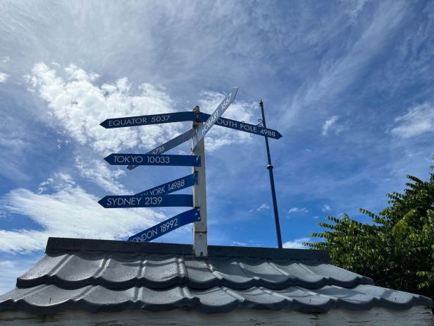
We finally found a café in Lumsden. It was called Roasted x Toasted (13 Diana Street, Lumsden). I surprised Lucie by having a delicious looking (and tasting) carrot cake for my breakfast and she, more predictably, had a brownie. In front of the café, we discovered a signpost that showed that we were almost as far from the equator as from the South Pole (both about 5000 kilometres).
In the “Southlands” (New Zealanders seem proud of their regional identities) there were long flat plains beneath the mountains – and that meant long, flat and arrow-straight roads. I drove the last 70 kilometres at a completely unusual speed (almost 90 in some places!!!) and later told Lucie that I had enjoyed a nice varied ride on that day.
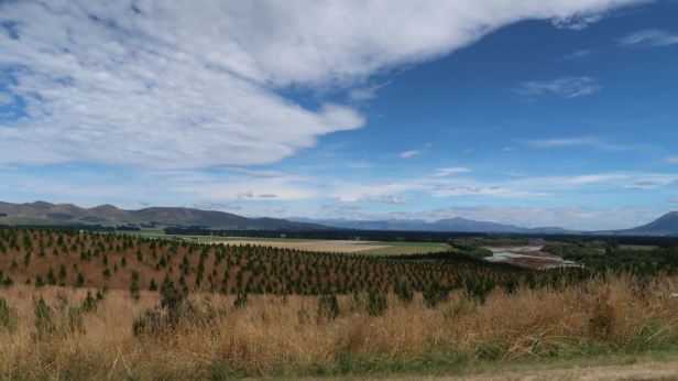
It was bright, but also very blustery. We had noticed all over both islands, that the more delicate fruits were usually planted in orchards that were surrounded by high, square-cut boundary hedges. These were of some variety of evergreen tree and were there to protect the crops from the often ferocious winds. These seemed particularly prevalent in the far south.

We arrived in Invercargill and easily found our nice, motel-type accommodation. We stayed at the Golden Leaf Apartments (15 Thomson Street, Avenal, Invercargill).
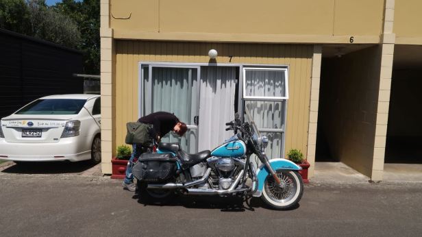

Because my dear wife continuously panders to my needs, the accommodation was only a couple of minutes on the Softail from the E. Hayes and Sons, Department and Hardware store (168 Dee Street, Invercargill).

This vast emporium sells everything imaginable in the domestic and hardware spectrum. It also contains a large and very interesting exhibition of archaic machinery and, more importantly, classic motorcycles.

I counted no less than three examples of the famous Ariel “Square Four” amidst a sea of two-wheeled history that included ancient marques I had never heard of, Harley-Davidsons and Indians.
It was one particular Indian that I (at least, Lucie was more fascinated by other exhibits) had come to see. And there it was ! Safely protected by a glass case, the 1920 Indian Scout 500cc, upon which local “hero” Burt Monroe had achieved a stunning 184.087 miles per hour (296.259 kph) at the Bonneville salt flats in August 1967.
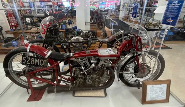
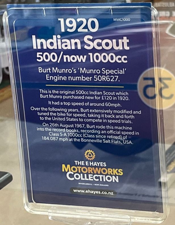
The Scout was, of course, bored out to 1,000 cc by then – but it was 47 years old ! I love motorcycles, but it was hard to imagine such a stripped down and primitive looking thing moving as much as a centimetre, let alone blasting down the Bonneville Salt Flats at approaching 200 miles per hour ! The accompanying exhibition also included a display of the burned out pistons that Burt went through in his quest for the record (which still stands as the “class” was later discontinued) labelled as “Offerings to the Gods of speed”.

Also present are two replicas of the bike in its “streamlined”, record-breaking, form. These were used in the 2005 film “The World’s Fastest Indian” which starred Anthony Hopkins as Burt.

The atmosphere in the store was slightly surreal. The staff are well used to people coming in, not to shop, but to view the exhibits and they are keen to chat. Whilst there, we did actually want to try and get a piece of white card and a marker pen for a future piece of silliness when we came to the town of Gore. I have a good friend who grew up there and I wanted to tease him from afar. One assistant went into the store room to find us a piece of white cardboard, which he gave us for free – and then loaned us his own marker pen to do the writing ! What a wonderful gesture !

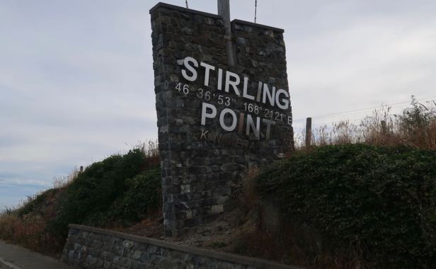
Then it was on to the next point on the program, Stirling Point. First of all, another slight mistake made at home in Prague, when doing the planning crept in again. I had always been told, by Kiwis that I had met, that the most southerly point of mainland New Zealand was at Bluff, just south of Invercargill. I had told Lucie this and she had discovered the road through Bluff led to a spot “near” (more on that shortly) Stirling Point. This had gone into the plan. A bit of subsequent research revealed that the most southerly point is (now) considered to be Slope Point and I assumed (and we all know what that does) that they were one and the same place. Clang !!! Slope Point is actually 70 kilometres around the coast to the east and it is something a bit less than half of a geometric “second” further south – say around 450 metres. In addition, it is far from the nearest sealed road and getting there would involve a long hike. By the time we realised the discrepancy, it was too late to do anything but go to Stirling Point !
We drove into Bluff. As ever, I was given pause for thought by the war memorial. We were at the bottom of the habitable world and about as far from the Western Front as it is possible to get – and yet a great number of men from Bluff sailed away – and never came back.

We continued around the bay and found the car park. There was a lot of signage that certainly implied we were at the most southerly point.
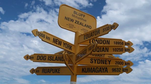
One of those signposts showing the distances to other places. One mentioned was Cape Reinga (no doubts on THAT one, at least !) which was indicated at 1304 kilometres away, less than a third of the distance we had covered since we had stood there fifteen days previously. The fact there were so many people at Stirling Point speaks for the fact that we were probably not the only people who had thought the way we had…..
Because we had ridden about thirty kilometres to get there, we were in our biking (and not our hiking) clothes. The latter would have been much better, because it had become quite hot. As I was already a bit sun burned (to go with a bit toaster burned), I dare not take too much stuff off, so I had to hike round with my shirt on. At least my tongue had finally stopped bleeding !
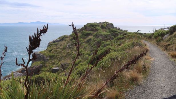
Maps can be a little misleading sometimes. What, according to the map, appeared to be a fifteen to twenty minute wander, turned out to be a slightly taxing, particularly in the sticky heat, round-trip hike of around nine kilometres. It took us well over an hour to complete.

The scenery was, as we had come to expect, totally stunning as far as the eye could see.

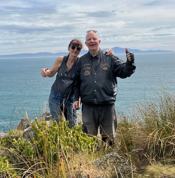
When we finally stood on the point itself, we considered it quite an achievement ! We managed to photograph ourselves with the aid of “tripey” our little tripod.
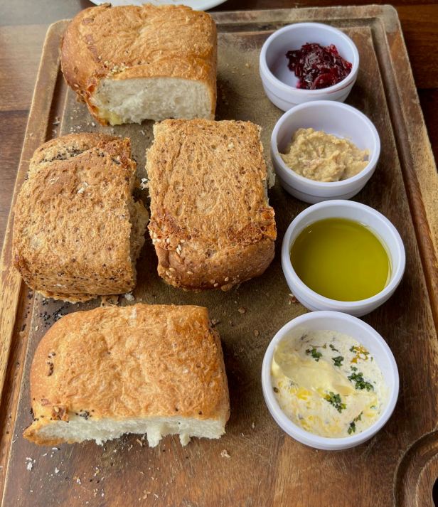
Tired and sticky, we finally almost crawled back into the parking lot. There was a café/restaurant on a slight rise above the parking area and we arrived with a small glimmer of hope that it would still be open and not fully booked. It was and it was not ! Hooray ! It was called the Oyster Cove (8 Ward Parade, Bluff).

The food was, to put it simply, superb and easily the best that we had eaten in New Zealand up to that point. We had a starter of homemade bread and a selection of dips.
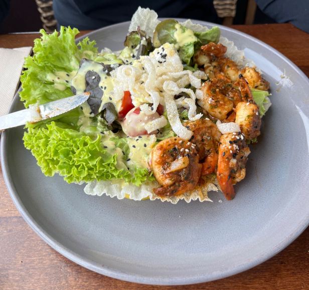
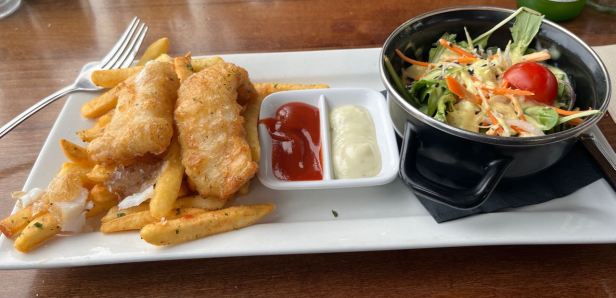
Lucie then had prawns and I had the fish, which was Blue cod and chips.
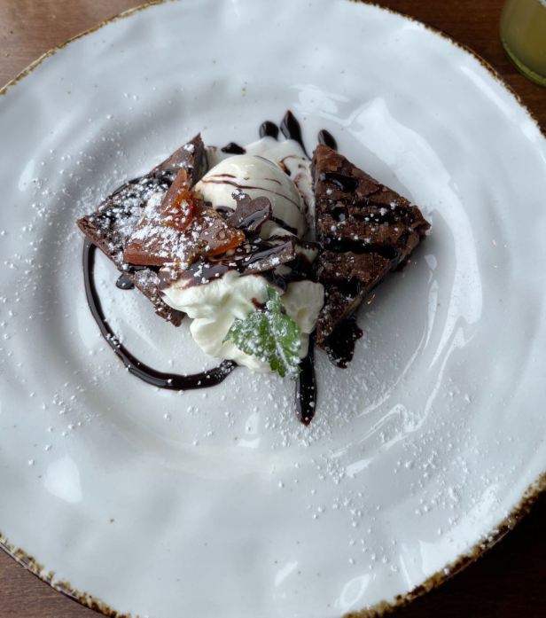
Dessert was brownies that were warm from the oven and simply divine. How strange that such superb dining could be had in what is really quite a remote place !
We drove back to Invercargill in the late afternoon sun that was turning into evening by the time we got there. Lucie was quite tired, but settled herself into planning for the next day. I had heard that there was a memorial to good, old Burt Monroe to be found in Queen’s Park which was essentially, right behind our motel. I wandered around the corner with my camera. The first thing I saw was a peculiar, stone, Iguana……

…. and, sure enough, not far away, there was a determined looking Burt, crouched behind his streamlined fairing, appearing to be heading into the distance at 184.087 miles per hour.


The park was built on land given to the people of Invercargill by Queen Victoria. It was huge, immaculately maintained and full of wonderful flora that Lucie would have enjoyed. She missed the park, but she did get a brief glimpse of the eternally speeding Burt Monroe when our route out of town took us nearby on the following morning !
