Thursday, May 4th, 2006 – Distance Travelled 354 miles
I am, by nature an early riser, but the following morning for some reason I overslept quite considerably. I felt pretty groggy a tiny bit feverish and a bit disoriented. Maybe it was exhaustion, the previous day had been very tiring mentally or maybe the soaking I had received had given me a bit of a cold. I think it is fair to say I probably was not at my best and it was already some time after eleven before I donned my now (thankfully) dry clothes and dragged myself to the checkout.
The weather outside was still blowy and fairly chilly, but at least it was not raining. Dark grey clouds in the distance and, of course, to the west where I was going, threatened that the dry respite might be only temporary. Not a pleasing prospect, but at least the Fat Boy looked shiny and clean after hours in nature’s jet wash.
I have already admitted to being woefully lax with my pre-trip research, but one thing I did know was that Route 66 cut across the bottom south-east corner of Kansas – and the I-44, which I had arrived on, did not.
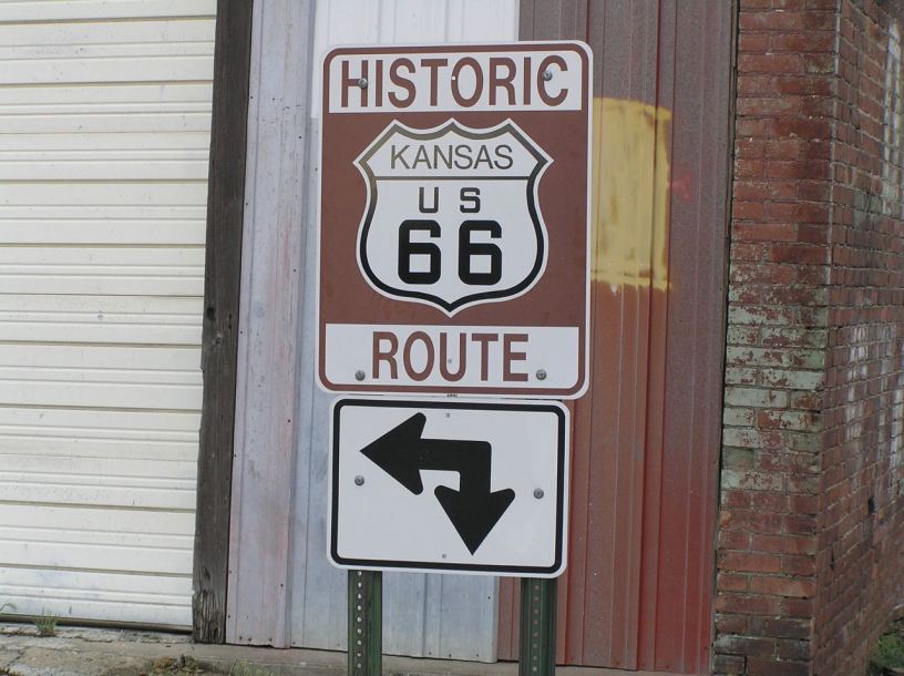
Fortunately, the man at the check out was a proverbial “old timer” and a bit talkative too. He seemed almost thrilled that I had come so far and told me that I must have missed a sign the previous evening, but not to panic as I had not yet gone far out of my way. He explained that, if I headed north on the road outside the motel (Missouri 249) instead of south and back to the I-44, I would soon come to the plain old Route 44 which, if I turned left, would soon become the old Route 66. You cannot beat a bit of local knowledge and he was exactly right. Within a few miles I was on the Route 66 and soon crossed into my third State of that trip, Kansas.
In case anyone cares, the Route passes through 8 States and such is the brevity of its passage across the south east of the State that Kansas is the only State in the song which does not get a place name mentioned in the song.
This was far more rural riding and, if it had been more sunny, it would have been very pleasant. I followed the road through Galena and eventually came to Baxter Springs, where the brown signs directed me onto Route 166, which did at least seem half logical. I rode this for quite a distance before I realised that the brown markers had quite disappeared. While I was still pondering this, I had one of those “moments” that I will never forget – and not in a good way. The route, as I have said was quite rural, gently twisty and undulating. It wound through farm country and was closely flanked, in most places, by white painted rail fencing. Having mainly ridden the Fat Boy that far on highways and city streets, I was still “learning” it, so luckily I was not going that fast. I came around a ninety degree bend and saw that a very short distance ahead, there was no road surface at all, just a sea of loose pebbles.
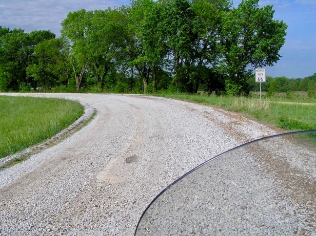
At the risk of sounding casual about the next ten seconds or so, all I can say is that the experience gained from over a million miles of riding somehow prevented a disaster. In retrospect, I do not really remember getting vertical, locking my arms and closing the throttle, but I must have instinctively done all those things correctly. Suffice it to say that I somehow coasted to a controlled stop about one hundred and fifty yards down the road. Suffice it also to say that, having stopped safely, my heart was in my mouth and I was shaking like a leaf in a gale. It was many long minutes before I gingerly set off again. It was very difficult riding, the stones slid everywhere at the first hint of acceleration and, for the first time, I could fully appreciate just how heavy the Harley was. After a couple of miles, the road surface returned. I had seen no warning signs at the first end and there were certainly none at the far one. Perhaps people in south-east Kansas hate bikers ….
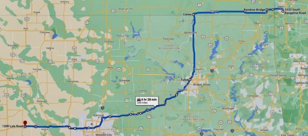
I stopped for coffee in some little town I do not remember the name of and wondered what to do about the “vanished” Route 66. It was an age since I had seen a sign and I was quite a way directly west by then. I needed to go south and decided to take that direction at the next available opportunity. In the event, I came to Route 75 in a place called Caney, only a few miles later and Tulsa, which I felt was far more where I needed to be, was signposted away to the south. I turned left.
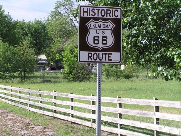
Almost at once, in warm sunshine, I came to my fourth State, Oklahoma. Needless to say, with a hideous synchronicity, out of a clear blue sky, the heavens suddenly opened again. I have already said that the rain appeared worse in wide open spaces and this was no exception. It was a spectacularly heavy, vertical downpour that I am tempted to describe as a monsoon. I was drenched in seconds and it seemed to be passing directly through my clothing and onto my skin. It actually stung. In the end, I just gave it up and pulled into a gas station to wait it out. It was over an hour before the rain even started to slacken and probably closer to two hours before it finally stopped. As if mocking me, the sun came out as I walked back to the Harley.
I set off down Route 75, still damp and quite aware that it was now mid afternoon and I had not done much over one hundred miles. Not exactly what I would call progress. In the end I came to Tulsa where I encountered my old friend the I-44. I noted that, to my left (I was going right) the I-44 was billed as the “Will Rogers Turnpike”, hinting at its Route 66 connection. As I crossed the Arkansas river, I could not help but wonder how far off track I had been for some or most of the day.
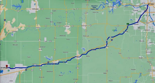
Not far south of Tulsa, I spotted a familiar brown sign and finally located some really “definite” Route 66. It was narrow and winding and progress was slow, but it was what I was there for. The day was starting to a come to a close and when I finally came to what seemed to be the end of that stretch of the original road, when it joined to the I-35 a few miles north of Oklahoma City. As that is in the song, I headed south and before long came to the Route 40 where, hooray, there were Route 66 signs.
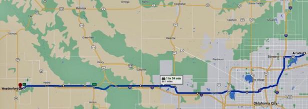
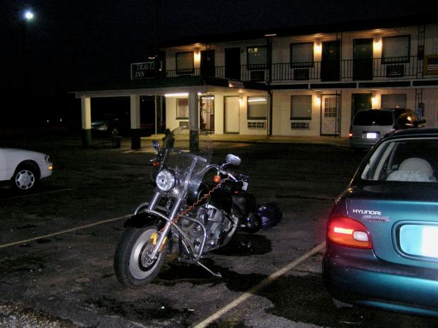
These took me through Oklahoma City and away to the west, often paralleling the trusty old I-40. This was actually quite a significant stretch of the old road. Sadly, because of the proximity of the Interstate, most of the commercial stuff you need as a traveller, motels, restaurants, etc., were on the newer road and, by virtue of fencing, totally inaccessible. Finally, at the town of Weatherford, all the Routes 40/66 and I-40 seemed to come almost together and I saw, not far from the road, the welcoming sign of a Travel Inn (3401 E Main St, Weatherford, OK 73096). It was a tiny bit “low rent”, but it had vacancies, so I checked in. I had actually come over three hundred miles by then and I was fairly tired. I was also fairly hungry. The guy on reception directed me to a nearby diner, Lucille’s Roadhouse Diner (1301 N Airport Rd, Weatherford, OK 73096) which was only about half a mile away, so I surprised him by walking there. Pleasingly decorated with Route 66 signage, this place offered standard diner style cuisine. I chose a burger and got the kind of burger only Americans can make. It was totally delicious and did not require the huge amount of fries that inevitably accompanied it. Again, I could not finish them.
Back in my room, my still damp clothes on the heater, I once again slept like a dead person.
