Sunday, May 31st, 2026
Distance ridden – 198 Kilometres
Another early morning, another fine day but with the threat of rain in the late afternoon. We loaded up the Softail and included our waterproof jackets, just in case.
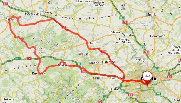
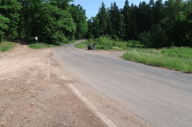
We crossed the quiet city and headed out in a westerly direction, initially on the D6 motorway, but only for about twenty kilometres before we began to go cross-country towards the town of Rakovník.
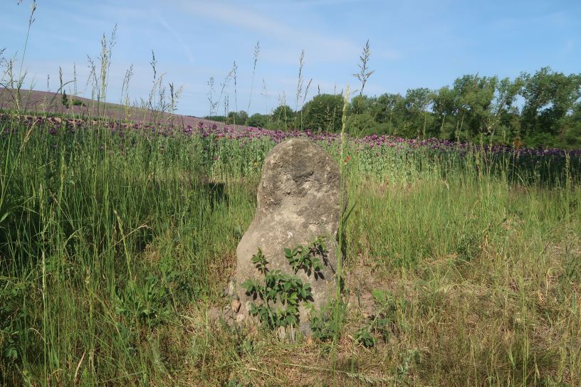
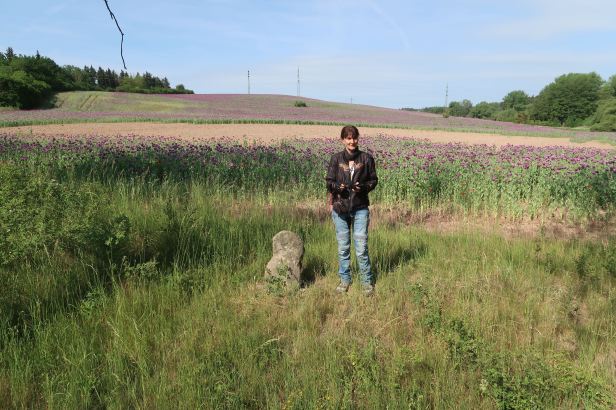
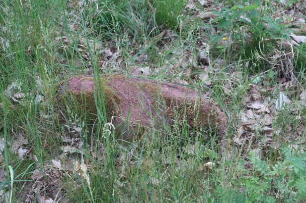
The Stone Virgin (Kamenná Panna)
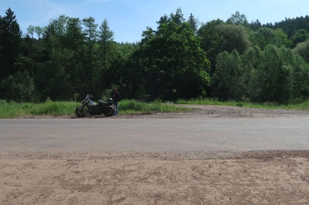
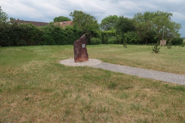
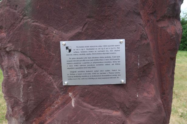
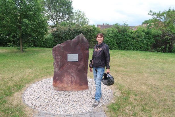
Lucie and I recently competed in the annual “Harley Challenge” in favour of the Nedoklubko charity and the route this year had taken us to a Kaufland Supermarket in Lišanská street in Rakovník. That had been three weeks previously and, at that time, there had been a lot of roadworks and road closures that made both finding and leaving that check-point a bit difficult. I was quite surprised, therefore when we cruised sedately past the same Kaufland and into a previously unexplored part of Lišanská street where we located our first Menhir of the day beside the road less than a kilometre from the supermarket.
When I saw it, I realised that it was one of those that I visited in the mid nineteen-nineties. We had no internet or GPS in those days and I remembered walking up and down the road several times before I spotted it in the weeds !
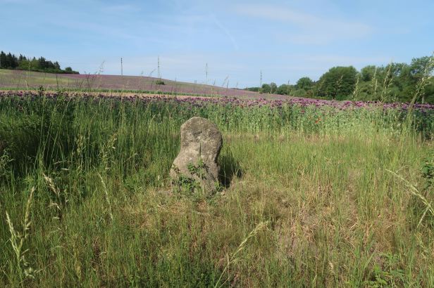
There are no houses nearby, so I cannot give a street address – the GPS location is 50.1177917N, 13.7334014E.
There is a shooting range very close to the Menhir, so keep your head down and try not to be startled by loud bangs !
The Menhir is quite small.
It is made of sandstone and, as is often the case, there are a number of theories about it. It appears to be of megalithic origin, but some people think it was merely a landmark – or maybe a stone cross, weathered by the wind.
There is always a legend and, according to this one, the Menhir is a girl punished by petrification for the impiety of not saying her prayers properly.
I will go with that.
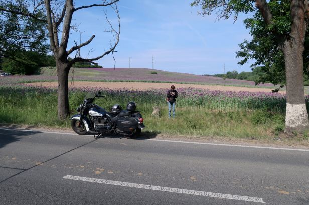
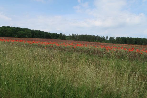
We set off through some more simply glorious countryside. The poppy fields were like a painting by Monet.
==
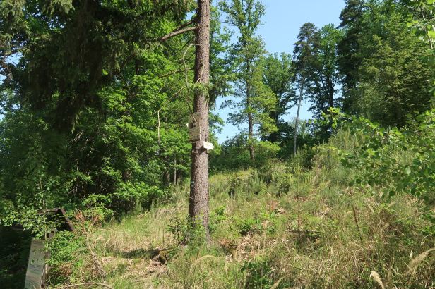
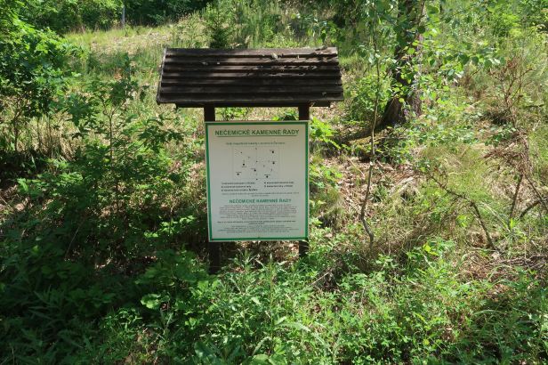
The Nečemice Rows (Nečemické řady)
Not so well known (indeed, I had never heard of them) as their neighbours at Kounov, are the stone rows at Nečemice.
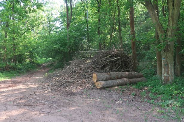
Stone rows are inclined to be big things over quite an area and, usually, fairly remote. Those at Nečemice are no exception.
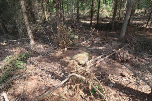
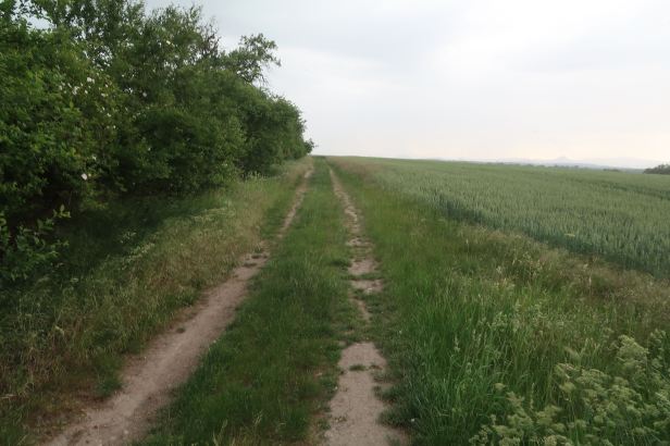
We drove along the road 22217 between Nečemice and Lhota until we had got as near to them as we could. I parked the Harley on the edge of a track into the forest at this point 50.247848, 13.623321 (although it is the first real opportunity to park that you come to.
The rows are on top of the forested ridge, between one and a half and two kilometres from the road. That means a four kilometre hike there and back which will take a good ninety minutes. It was not easy going.
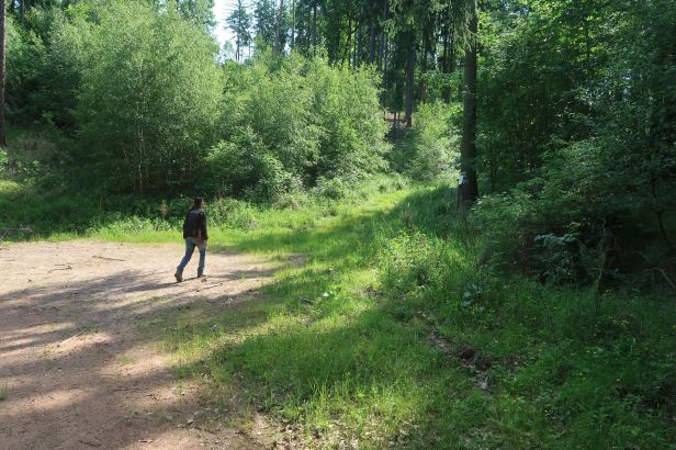
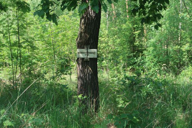
The BLUE way markers take you almost there but, rather confusingly, the only specific signage that there is does not really help at a critical moment and, if anything, directs you the wrong way …..
The GPS location of the rows is 50.2532067N, 13.6329397E
Eventually, with the aid of Lucie’s Mapy app on her iPhone, we did find them.
Sadly, even up close and personal, the rows are hidden by undergrowth and very hard to spot.
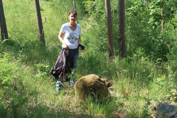
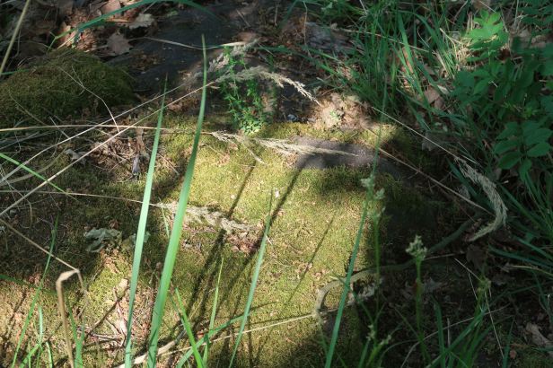
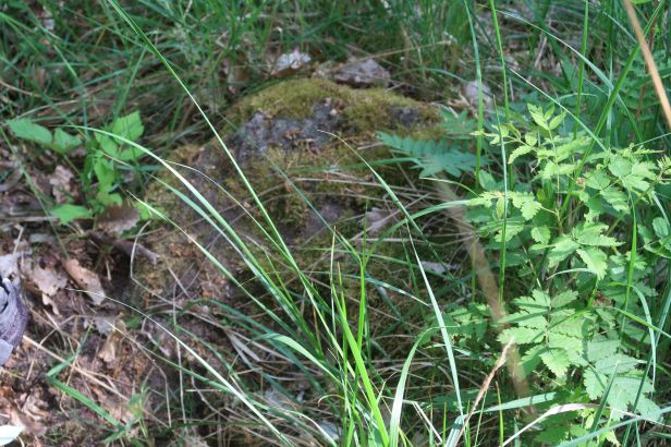
They are there though – and they are in rows.
So, someone not only dragged them up there but also manoeuvred them into position. They are not individually huge, but not a single one of them would take less than two or three men to move it.
I was slightly saddened that there was not more to see, but my first sight of Kounov, back in 1994, was very similar.
We made our exhausted way back down which, due to the thickness of the undergrowth, was almost as hard as the ascent had been.
At the junction of the track there was this sign which shows how, even in those far off times, all the rows and Menhirs pointed at the Azimuth of the sunset on mid-Summer’s eve.
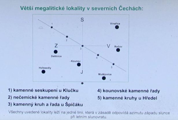
Sadly, Hředel (5) was destroyed in 1957.
==
The Cursed Girl (Zakletá dívka)
This 135 cm high Menhir originally stood in a field on the road to Malnice.
I love legends.
According to the one associated with this stone, a farmer once took it from its original place to make a seat out of it at his farm. However, at night, dogs gathered around the stone and howled pitifully. This eventually forced the farmer to return the stone to its original position.
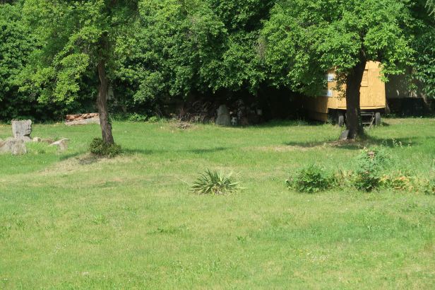
For some reason, the Menhir was toppled and then lay for a long time in the ditch of a district road near to its original location. As it was felt to be in danger of being destroyed, in November 1986, it was transferred to the Regional Museum of K. A. Polanek in Žatec (Husova 678, Žatec), where it was placed (unobtrusively) in the garden.
On a Sunday, the Museum was, quite naturally, closed. Luckily, we could just spot it through the fence.
It was our intention to visit its original site, but circumstances were soon to conspire against us.
–
In case you care about these things, the original location of the “Cursed Girl” and the site of the “Stone Virgin” near Rakovník, lay on EXACTLY the same meridian ……
==
We were both pretty hungry then so we decided on a spot of lunch.
Besides having its museum closed, Žatec, on a Sunday is definitely not a place to be hungry. Luckily, we did locate the Restaurant U Orloje (náměsti Prokopa Velkého 1951, Žatec) which was helpfully part of the U Orloje brewery complex. The food was basic, but good and well priced. The alcohol free beer was, I believe, the best I have ever tasted. We put a litre and a half into the saddlebag …….
==
Menhir Selibice
We filled up with petrol and set off for nearby Selibice.
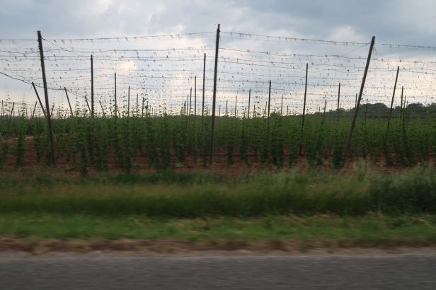
The area around Žatec is where the majority of hops for the Czech beer industry are grown.
Selibice is at the top of a steep narrow road with a severe hairpin bend. It is a tiny place and, as such, the streets appear to have no names. That gives me an idea for a song ! We parked outside (Selibice 50, 440 01 Staňkovice – Selibice)
The Menhir is located in a small park, by the house. If, for some reason, you cannot see it, try, 50.3436044N, 13.6130006E
The Menhir is a 1.7-meter-high stone weighing approximately one thousand kilograms (one metric ton).
It is a modern replica of an original which was found, in 1983, in a meander of the Ohře River.
The Menhir is made of gray-pink double-mica orthorrula. This is notable as the nearest occurrence of such a rock is in a distant valley in the Krušné hory (Ore Mountains) which are over 60 kilometres away.
The original Menhir is currently stored in the Regional Museum in Louny.
=
The Cursed Monk (Zakletý mnich)
Storm clouds were now gathering fast – so much for the weather forecast, as it was only a few minutes after two in the afternoon.
It very much began to look as if our last two intended destinations would not be receiving a visit today.
We left Selibice for the short drive to Drahomyšl, which was only about eight kilometres distant. We started on unnumbered roads, but we entered the town on Road 225. Lucie guided us to a large pond and I drove as far as I dared up an un-metalled track which was at least heading in the right direction.
Finally, I dare go no further, so we parked and walked the last three or four hundred metres. As we dismounted, the first few blobs of rain fell onto the tank. I will not go so far as to say that we ran down the track, but we definitely did not dither.
The Menhir itself was easily located. It has a sign – and a track through the crops, but it is also a big one. The second biggest in the Czech Republic (and probably, the second most famous).
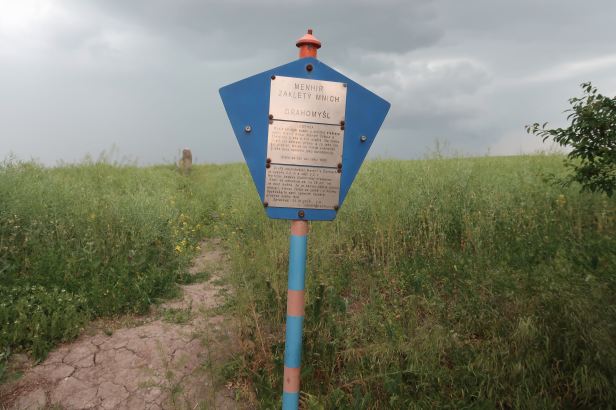
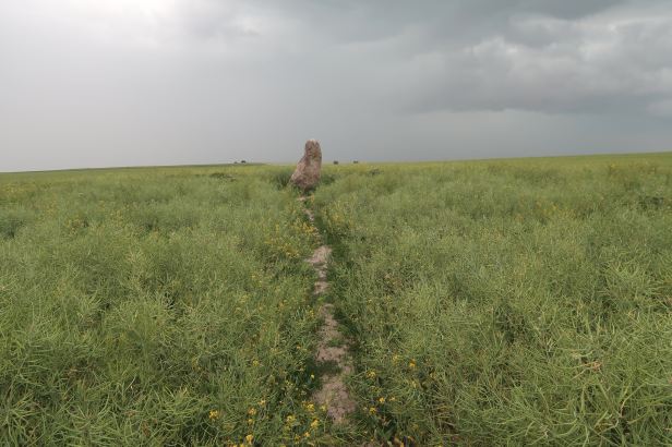
It is made of grey quartzite, it is 2.2 metres tall, 2.5 metres wide at the base and is estimated to way over two thousand kilograms (two metric tons).

In case of difficulty 50.3150644N, 13.6490792E
Local folklore claims a monk from the Capuchin monastery in nearby Žatec fell in love with a local girl and convinced her to run away with him. As they fled, they were stopped by the prior of the monastery. The prior cursed the monk, causing him to instantly freeze and turn to stone. The girl was subsequently accused of witchcraft and burned at the stake. As it is a legend, maybe she got away with it !
It is also rumoured that the Menhir stores dark energy which would be released if it was to be moved. I decided not to take it home.
–
As we trotted back to the Harley, the heavens quite literally opened and, before we could even struggle into our yellow waterproof jackets, we were both soaked to the skin.
–
Oh dear !
This was bad – and we were close to a hundred kilometres from home.
It was raining so hard that visibility was practically zero – but remaining where we were was to invite a vertical drowning. I set off quite gingerly, the track had been a bit dodgy on the way in and it was worse now.
The SatNav pointed us towards Louny and we trundled along road 225 as I tried desperately to see more than fifty metres ahead of me. Of course, country roads and such a colossal downpour meant the roads were covered in water and, in the small town of Lipenec we ran into what was, quite literally, a small lake. The Harley engine just stopped but, luckily, by pulling in the clutch I was able to coast to the kerb. When I put my foot down, the water level was higher than my boot, not that it mattered becauses the boot was already full to the brim.
We managed to get the Harley onto the sidewalk where I hoped against hope that the hot engine would dry whatever water had made ingress. Luckily, good fortune, or maybe the Monk back in Drahomyšl, smiled on us and, after a few minutes standing in the downpour, the engine started. It ran a little lumpily at first, but soon settled back into a regular beat.
We drove to Louny and then took the D7 Motorway back to Prague. Actually, to call it a Motorway is to pre-empt things – it will be one – but it still is not. Thus it was a seventy kilometre drone through endless roadworks. Luckily, there was, by that time, no way we could get any wetter.
We eventually gained the sanctuary of our garage – and Lucie laughed. Maybe the rain had affected her brain – or maybe she just enjoys her life. Who knows ?
