Wednesday, June 3rd, 2026
Distance ridden 112 kilometres (2 x 56 kilometres)
Distance hiked 8.5 kilometres – it felt much more !
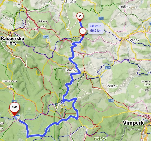
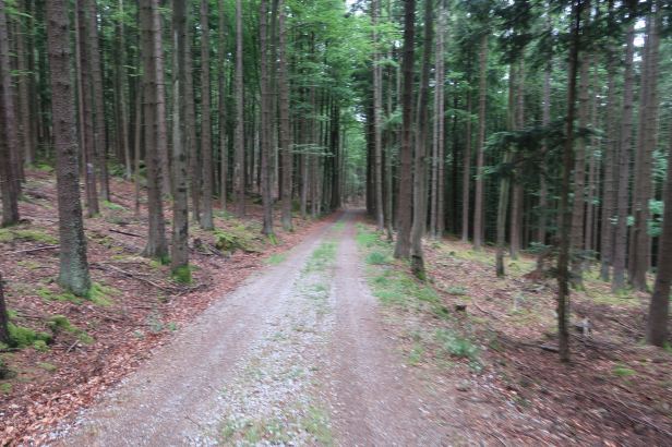
In the morning sunshine, we jumped onto the Harley and left our base in Horská Kvilda. For the next hour, we wended our way through some extremely “country” (as in narrow, twisty and often poorly surfaced) roads and lanes to the small mountain town of Javorník. This was a distance of about fifty-eight kilometres. Lucie’s research had revealed there was quite a number of significant Menhirs, in comparatively close proximity, on the wooded slopes of the peak above the town.
=
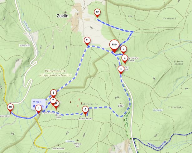
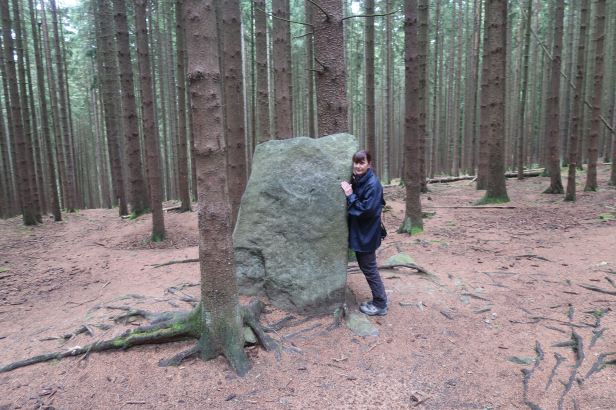
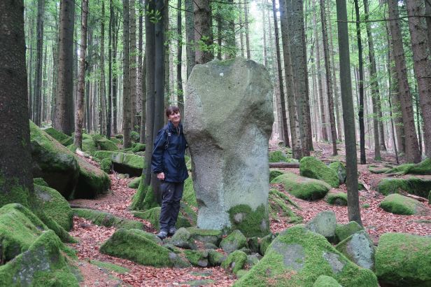
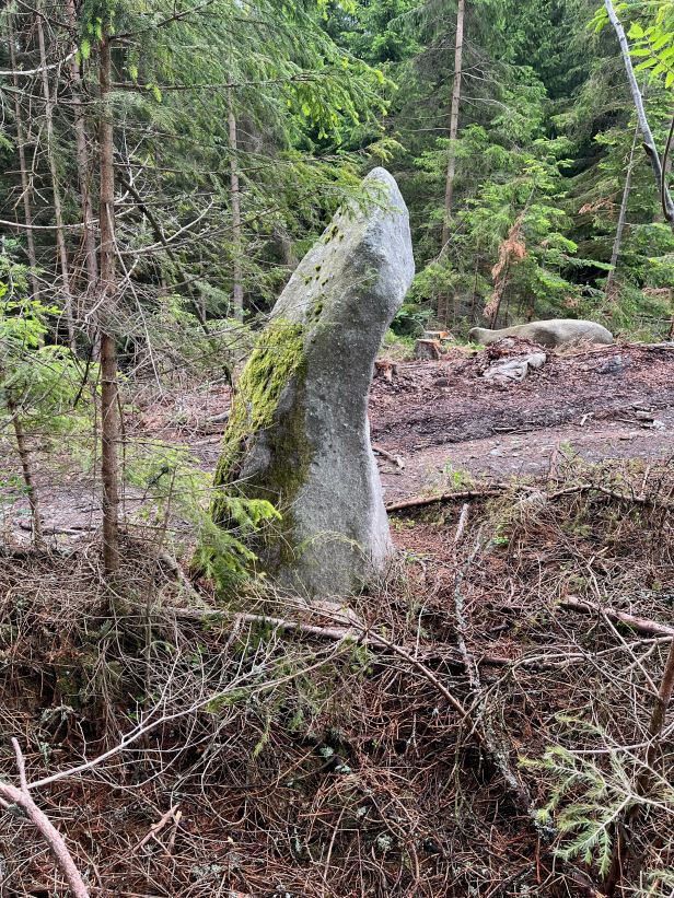
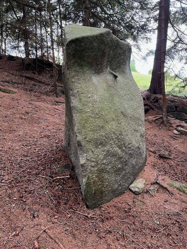
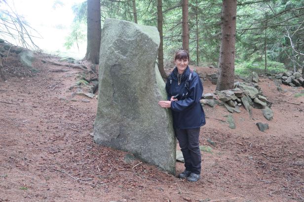
The Moonstone / Měsíční kámen
In the Javorník area, this is the most famous menhir of all. We took the road from Javorník towards Strašín. Less than 2 kilometres from the small town of Javorník, we parked the Harley beside a small designated parking area with an attached wooden tourist shelter, (both were temporarily closed as the woodsmen were enthusiastically felling trees very close by).
END on the map (END covers the 1).
We located the Menhir, quite easily. It was in the trees only about 200 metres away.
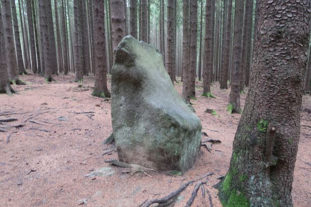
The Menhir is about 1.8 metres high. The shape of the Moonstone is atypical compared to most Menhirs, but there are similar ones in other places in Bohemia.
At the risk of sounding “new-agey”, in a psychotronic survey, made in 1994, the Menhir was found to emit energy. That changes it from being a mere Menhir into what Czechs call an actilite (glowing or luminous stone). The energy that is somehow generated within the stone spreads to a certain (but unspecified) distance in essentially all directions.
Number 2 on the map.
The GPS location is 49.1535136N, 13.6617828E
All kinds of strange stuff has been written about this stone. This includes the proposition that various sides of it have different energy levels and that there is a circle of “negative” energy, about twenty metres in diameter around the stone which serves to protect it.
Certainly, the stone does lay, as so many Menhirs do, on a direct line with many others. In England we call these “Ley” lines.
=
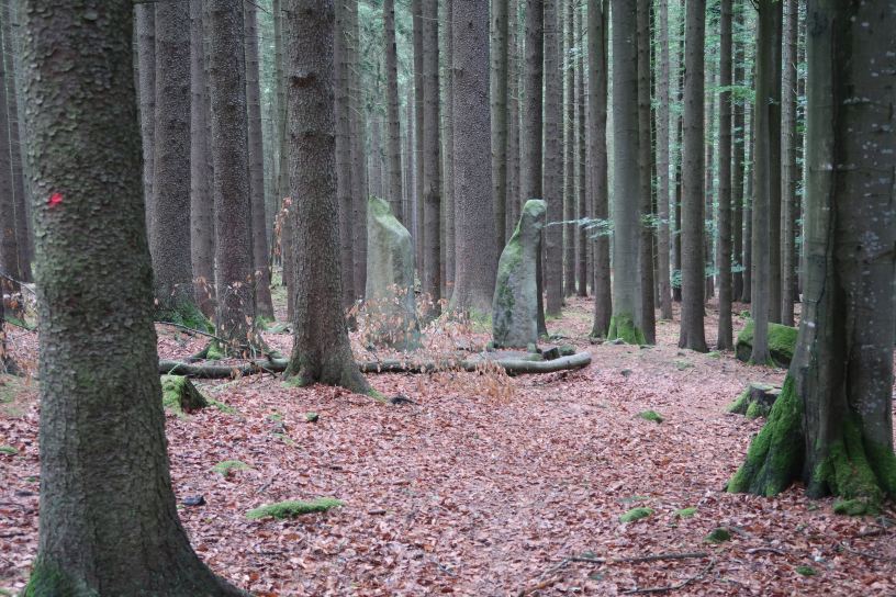
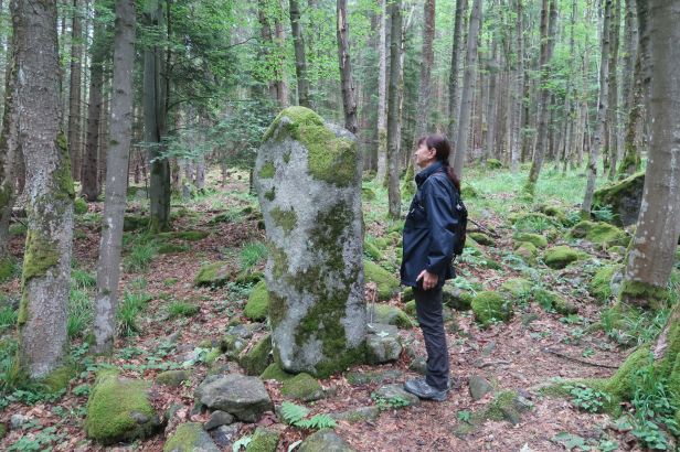
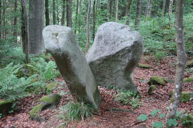
The Two Brothers / Dva bratři
(also known as The Guardians / Menhiry Strážci)
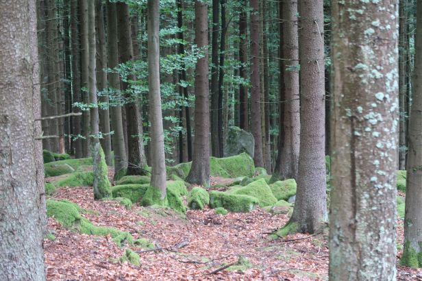
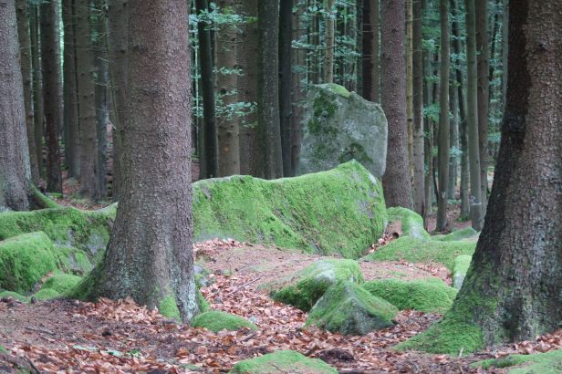
These two Menhirs are un-signposted and have no marked no trail leading to them. They are very near to the Moon Stone. We walked back along the road towards Javorník for around two hundred metres before Mapy indicated we were in the right place and then we re-entered the trees. The two Menhirs stand right next to each other, probably less than a hundred metres from the road and were quite easy to spot.
Of all the Menhirs we had so far seen and were to see during the rest of our hike, these were by far the most “magical”. There really was something special about them.
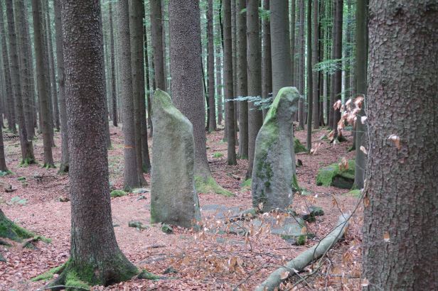
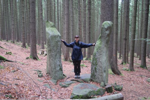
Number 3 on the map.
The GPS location is 49.1522900N, 13.6620600E
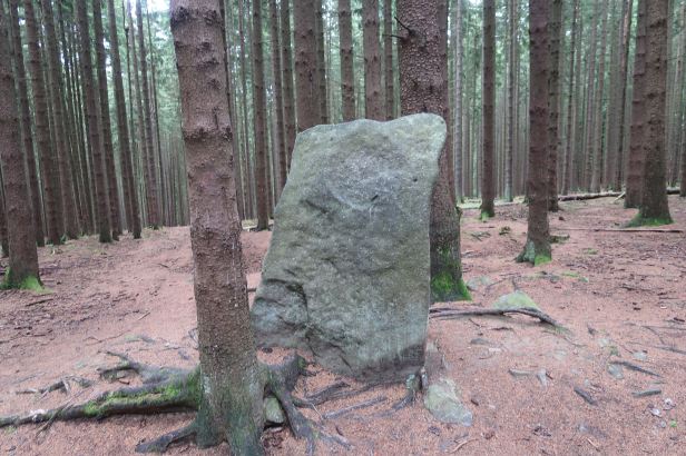
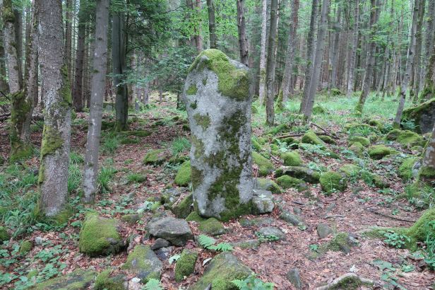
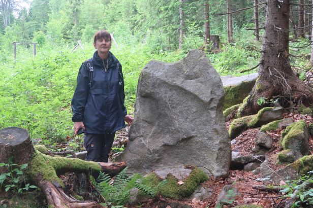
The Memorial Stone / Pamětní kámen
Almost reluctantly, we returned to the road and continued to walk back towards Javorník. After about three hundred metres there was a large stone on the left hand side of the road. It was easy to see and is simply known as the Memorial Stone.
It meets the basic Menhir criteria in as much as it is stone that was definitely placed there, but nothing is really known about it.
Number 4 on the map.
The GPS location is 49.1508050N, 13.6612694E
=
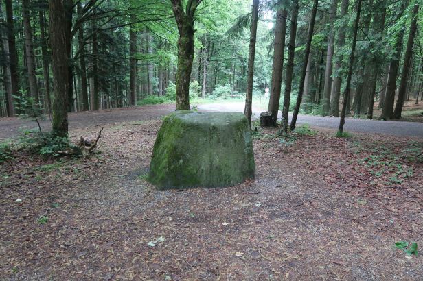
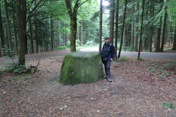
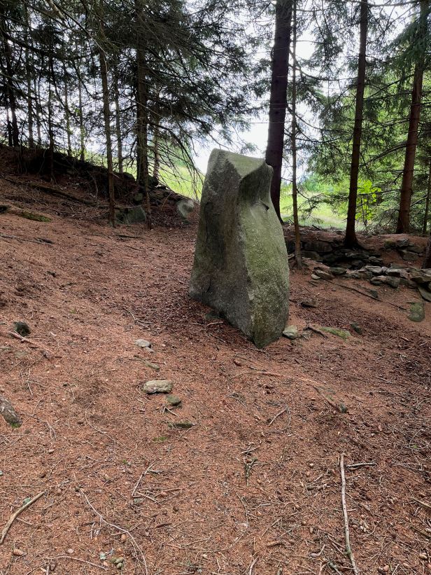
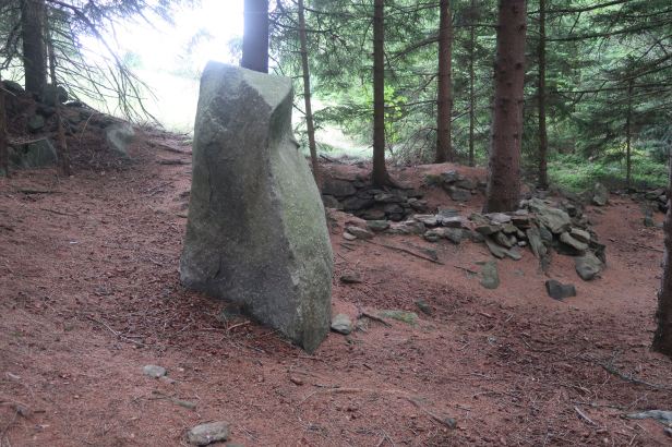
The Sage / Mudrc
Almost opposite the Memorial Stone, still in the direction of Javorník, a forest road led uphill into the National Park. We followed it up the slope for quite a distance, using Mapy to navigate the various branches in the track.
On an uphill stretch, we came to what is called a “stone sea”, that is an area of boulder size stones formed when larger rocks disintegrate because of weathering and frost. On the edge of this was the Mudrc Menhir.
This was an impressive stone. It is almost 3 metres high and (for “new-agers”, is said to radiate twice as much energy as other Menhirs).
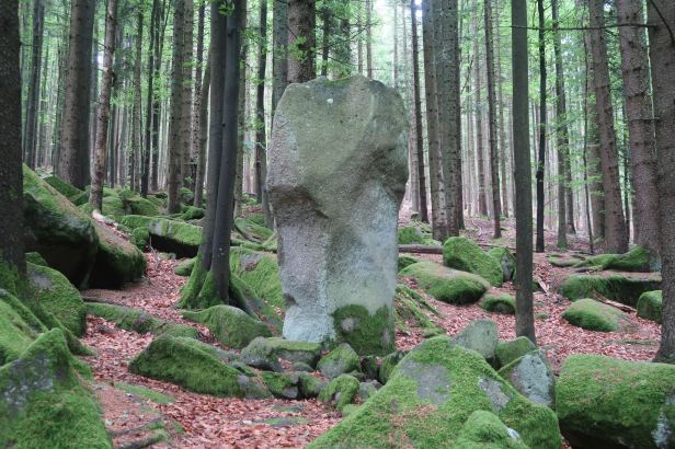
When it was first (re)discovered, it was tilted and it was later straightened into a vertical position. The name comes from the fact that its expanded upper part resembles a large head.
Number 5 on the map.
The GPS location is 49.1453447N, 13.6539069E
=
The Monk / Menhir Mnich
According to Mapy, there were four more Menhirs quite close by in the forest. But, according to Lucie’s research, they were not really significant.
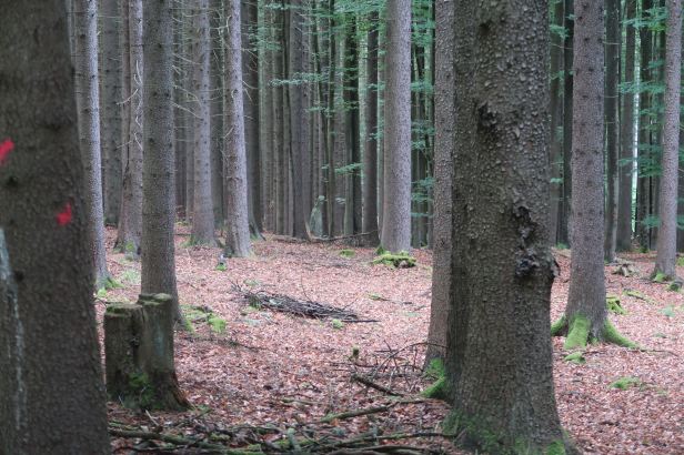
So, we set off down the forest road, passing some impressive rock formations as we descended. After about five hundred metres, we were prompted by Mapy to re-enter the trees to our right.
We soon found quite an impressive Menhir, standing about two metres tall amongst the trees. Legend says it was yet another petrified Monk. Perhaps it was wishful thinking by people in the middle-ages ……
Number 6 on the map.
The GPS location is 49.1461383N, 13.6478725E
=
The Basilisk / Menhir Bazilišek
A short distance further into the trees, standing in another small “stone sea”, we found another Menhir. This is one is called The Basilisk and was about one and a half metres high. Quite why it had such an impressive name, I cannot tell – and it looked nothing like its interpretation in the “Harry Potter” film …….
Again, there is not much additional information about it.

Number 7 on the map.
The GPS location is 49.1465453N, 13.6472681E
=
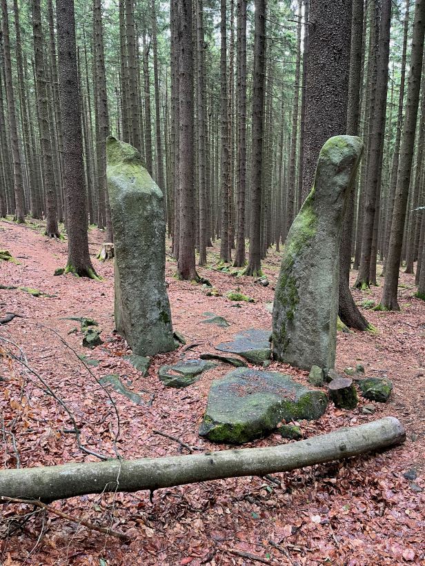
The Twins / Dvojčata
We carried on our descent and the road from Javorník to Strašín became visible below us through the trees. We followed a forest track and when we were really quite near to the road, just between us and it we came to another group of boulders in which there were a pair of “matching” Menhirs.
They were not, by any description, identical, but their bases were only about thirty centimetres apart, their heights were very similar at about 1.7 metres above the ground and apparently, the axis point of each one rises upwards at the same inclination.
Again, they have more than one name as some people refer to them as the Husband and Wife (which is probably related to the assumption that the ancient builders of the megaliths wanted to represent both female and male symbols in nature). Others (probably those “new-agers” again) have labelled them Yin and Yang.

Number 8 on the map.
The GPS location is 49.1475836N, 13.6473464E
=
The Forest Lord / Menhir Lesní pán
Although we could see the road below us, we climbed a few metres back up the hill to the forest track and set off back through the trees whilst again, slowly descending. When we were less than twenty metres from the road, we easily spotted, at the very edge of the trees, a smallish Menhir, just over a metre tall.
This is called the Forest Lord, but once again, there is not much information about it.
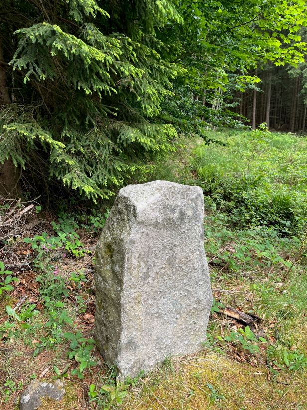
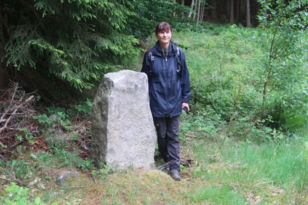
Number 9 on the map.
The GPS location is 49.1455050N, 13.6442661E
=
Lightning / Menhir Blesk
We walked to the road and began to follow it downhill, in the direction of Strašín. After about four hundred metres, as we rounded a curve, we could clearly see another Menhir.
This process was considerably aided by the fact that some recent tree felling had created a clear sight-line and, more worryingly, the clearance was up to a point within a few centimetres of the stone ……
To add insult to that injury, some Philistine had actually painted a way marker onto the actual Menhir as well as on a nearby tree.
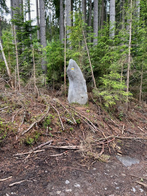
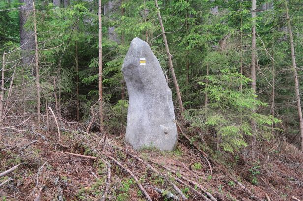
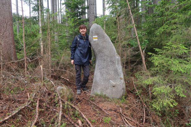
It looked better from the back !
Of course, maybe in pre-history, the Menhirs themselves acted as a kind of way marker and I got myself cross over nothing …….
Number 10 on the map.
The GPS location is 49.1456847N, 13.6384214E
=
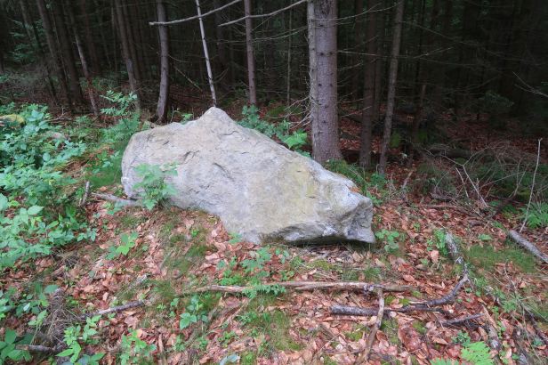
The Wind Stone / Větrný kámen
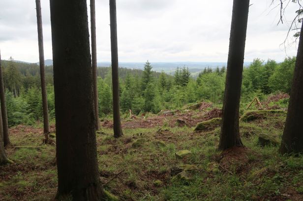
The Lightning Menhir was the apogee of our hike and we now turned back up the long hill in the direction of Javorník and to where the Harley was parked. The views over the countryside were beautiful.
We thought we had two Menhirs still to see, but one of them (Number 11 on the map) turned out to be a late 19th Century metal cross, beside the road. These crosses are everywhere you walk in Šumava, often regularly spaced along roads and hiking trails, many of the latter probably being the “roads” of the past.
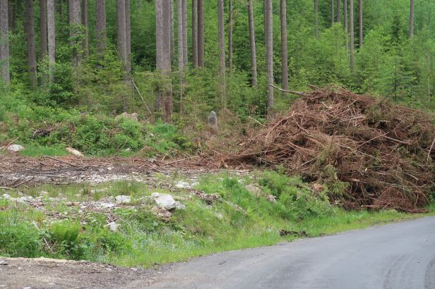
By the time we got back to the Harley, we were pretty tired, but there was still a Menhir of some apparent significance nearby. We followed a forest road into the trees where men were still enthusiastically cutting some down. We walked past large piles of freshly cut logs. The lovely smell of sawn pine was all around.
Still guided by Mapy, we branched left into the trees and things began to get a bit sticky. In addition to mature trees, this section had a large area of closely packed, newer growth that all but rendered the way impassable. It took us some time to trek around it and the difficult terrain eventually forced us out of the forest and into the meadows. We walked around the trees for a while before re-entering them and it was not long before we found our Menhir, the Wind Stone.
This was a real big one. It was almost two metres high and had an unusual triangular shape. It had a “sharp” side that faces exactly East.
Researchers believe that this Menhir, like some other standing stones, could have been used not only for religious rituals, but possibly also for healing or transmitting energy. Next to the stone are the remains of what is believed to be some kind of prehistoric sanctuary where weather divination was performed.
Number 12 on the map.
The GPS location is 49.1584739N, 13.6563744E
The Menhir was at the very edge of the trees so, rather than walk back through the forest, we crossed the meadows below the hamlet of Zuklín which was far easier and very pleasant. We later discovered that we could actually have approached the Menhir by the same route ………
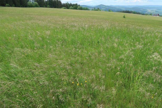
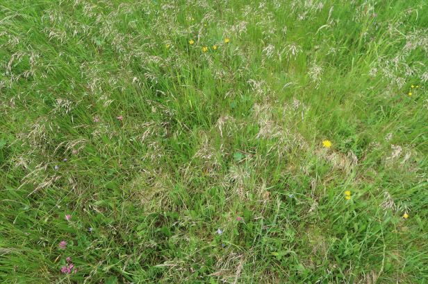
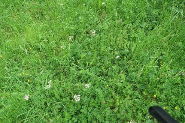
As I have said before, the meadows were an almost incredible mixture of grasses and flowers. Many of these, according to a botanist of my acquaintance, are now quite rare. In the sunshine, the aggregated scent of all those plants was quite intoxicating.
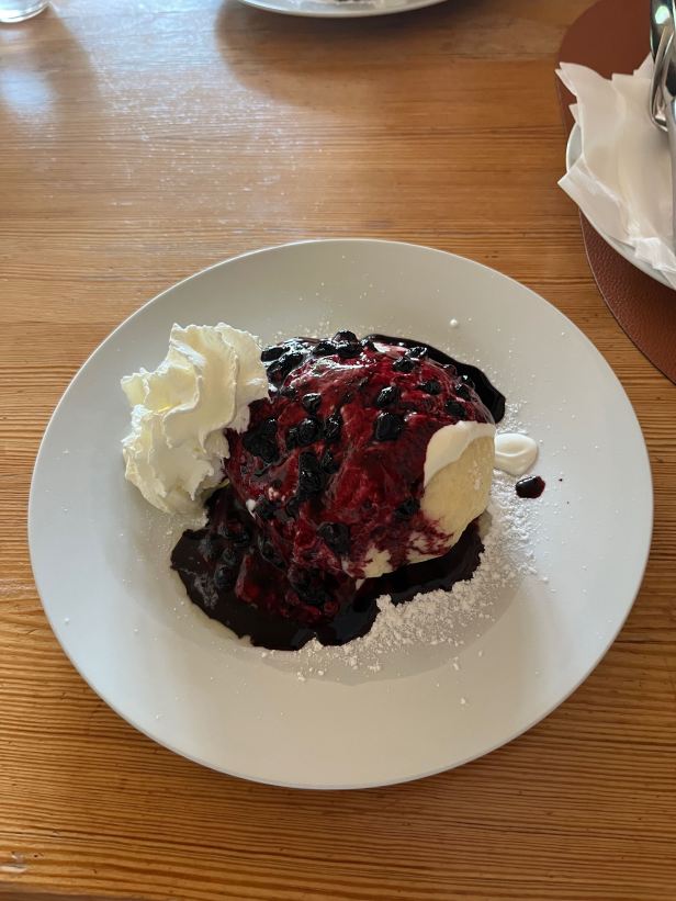
Once again “Menhir’d out” we got on the Harley and rode back into Javorník, where we had a nice lunch of Blueberry dumplings at the Restaurace Krásná Vyhlídka (Javorník 42, Vacov – Javorník).
“Krásná Vyhlídka” means “beautiful view” and the vista from the terrace, over the surrounding green and wooded countryside, was exactly that !
===
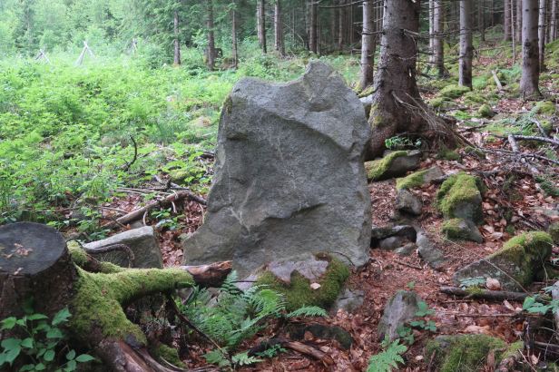
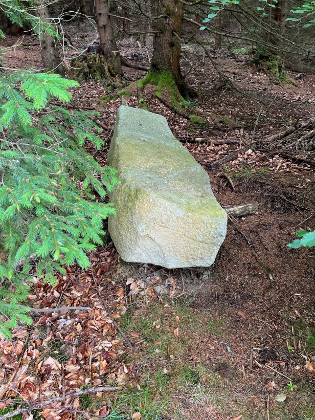
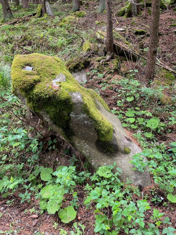
Other (unnamed/unidentified) Menhirs ?
During our perambulations, we were obviously focussed primarily on the Menhirs that were marked.
From time to time, in the trees, we also came upon other Menhir like stones that, because they were horizontal or, perhaps, toppled or fallen over in the distant past, do not meet the required criteria ….
Here are a few …..
=====
After lunch, we rode back to Horská Kvilda. We used a slightly different route, but it was not really any less distance – or any quicker.
–
After our exertions, we had a little lay down (OK ! I went to sleep !).
Lucie does not like the grass to grow under her feet, she would far rather trample it with her hiking boots so, before long I was roused from dreamland to go on another “little” hike she had somehow managed to plan during the fifteen seconds that my eyes were closed.
This was a, somewhat less strenuous, hike around the immediate area of our hotel and took us through yet more of the glorious scenery of Šumava on a circuit of “just” 5.7 kilometres.
The only problem with the hotel Rankl is that it is at the top of a hill – so the last bit is ALWAYS uphill.
For our evening meal we chose to go out, down the hill (yet again) to the Hospoda U Krámu (Horská Kvilda 34, Horská Kvilda) which offered a pleasing variety of traditional Czech dishes that were slightly more interesting than the slightly “standardised” fare in our hotel. I had Nakládaný hermelín (a pickled soft cheese) and Lucie had a nice (and probably local) Trout.
There was also a nice beer called březí husa (for some reason “pregnant goose”…) which came from the Panský brewery in Vlachově Březí. Very “hoppy” and very satisfying.
Then we walked back up the hill and you all know what happened next.
