Friday. June 12th, 2026
Distance ridden – 0 kilometres
Distance hiked – 17.6 kilometres
Oddly, given my undisputable predisposition for somnolence, I had great difficulty in going to sleep. I mention this purely because it is such a rare occurrence. By my standards, I was awake most of the night and, when I woke up at 06:30 (which at least indicates that I did, eventually surrender myself to the soft arms of Morpheus), I felt in no way rested.
It probably goes without saying that, while I was tossing and turning, my lovely wife had planned a hike.
Recently, probably as a by-product of my advancing years, Lucie’s hikes seem to be getting longer and longer. In truth, I do not think they are, but should I ever enquire how far it is to the next way-point, pub, finish, etc., it always sounds like a long way and, to achieve it, seems to require far more effort than I would have expected.
In short, in this respect, I have found ignorance to be superior to knowledge.
So, when, after a standard penzion breakfast, we donned our boots and went outside, not having asked, I was in blissful ignorance as to what lay ahead.
We strode off purposefully away from the penzion and off into the early morning sunshine. A few minutes later, having set off in the wrong direction, we re-passed the penzion – walking the other way. Considering how much Lucie loves a hike, her sense of direction often leaves a lot to be desired. I am a bit surprised that, when she goes mushrooming, she can find her way back. Do not even ask about left and right !
I would always go the extra mile for my lovely wife, but I tend to assume that is something that one does as a grand finale – and not as the prelude.
Anyway, we now walked up through Salaš. It was a friendly sort of place, people you did not know would wish you a cheery “Good Morning“. There was a driver, delivering meals for the pensioners and our progress up the hill matched his. By the time we came to the end of his route, we felt we knew him quite well.
At a small shop, Lucie stopped to buy some “Tatranka” wafer biscuits, which seemed particularly apposite as we were in the Tatra mountains. We usually take these on hikes and we have a strict formula for when they can be eaten. Generally, in a hike of less than 15 kilometres, we eat our biscuit after 10 kilometres. If the length is expected to exceed 15 kilometres, we usually go a bit before the 10 kilometre mark and then again, near the end. In the shop, she bought THREE ! Oh, dear !
We walked to the end of town and up a lane towards the forest.
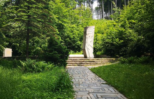
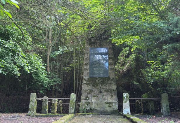
We had not gone very far when we came to a grim reminder of the town’s sad past. On April 29th, 1945, with the end of the war looming and Russian forces approaching, twenty men from the village decided to join the partisans. They met together and were approached by German troops, themselves disguised as partisans. When they declared their intentions, they were executed on the spot. The group included a father and his three sons and another father with two sons. One man escaped, but a local woman, fearing the worst and looking for the men, was beaten to death by the Germans to prevent her raising the alarm. The effect on such a small community must have been huge.
The town was liberated by the Russians a day later. There was an impressive memorial on the spot.
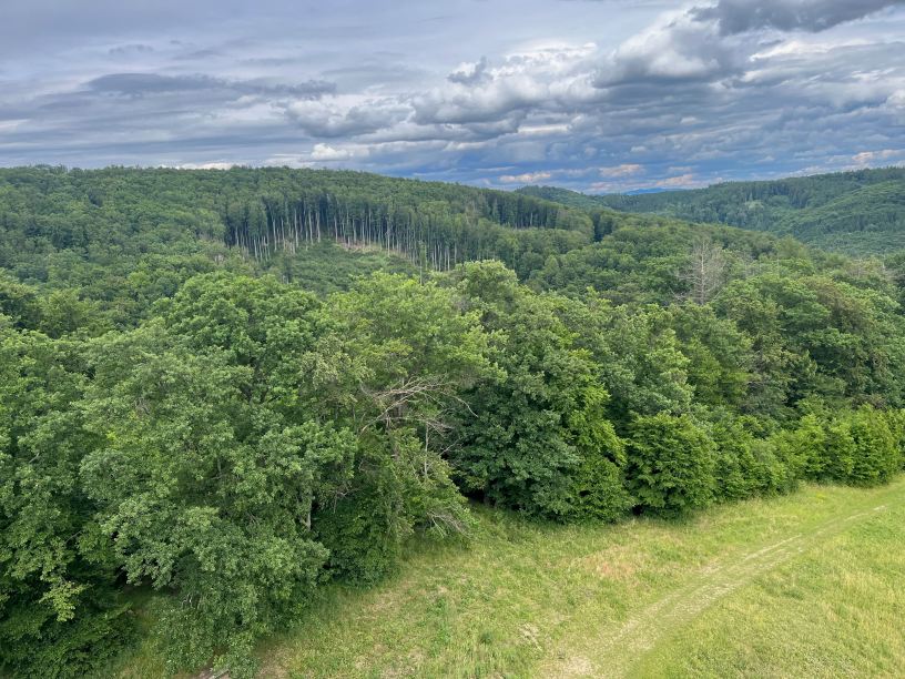
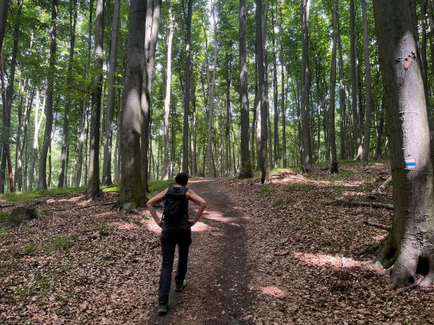
Sightly chastened, we began to walk up the hill out of town. Lucie does like to slip the uphill stretches in early, but this was a very long trudge up a slightly muddy forest track. I do mean long. It was one of those climbs where, every time you think you have reached the top, a glance past the next tree shows you were very mistaken. In truth, we did not climb to a huge altitude, but it did feel a long way. Unusually, in a land full of conifers, we spent most of the day in broad leafed woodland of beech, oak and rowan.

Finally, we did get to the top of the hill, at least as far as the hike was concerned. But, there was a nearby lookout tower, needless to say, even further up the hill, so we went there. The Brdo tower is an impressive structure at the very top (537 metres above sea level) of the highest mountain in the Chřiby range. Built in 2004, of sandstone faced concrete, it is 24 metres high and was the first stone lookout tower constructed in the Czech lands for over seventy years. The effort to construct it must have been huge. It is dedicated to the memory of local guide and hiker, František Mikula, who started a tradition of New Year’s Eve ascents to that point.
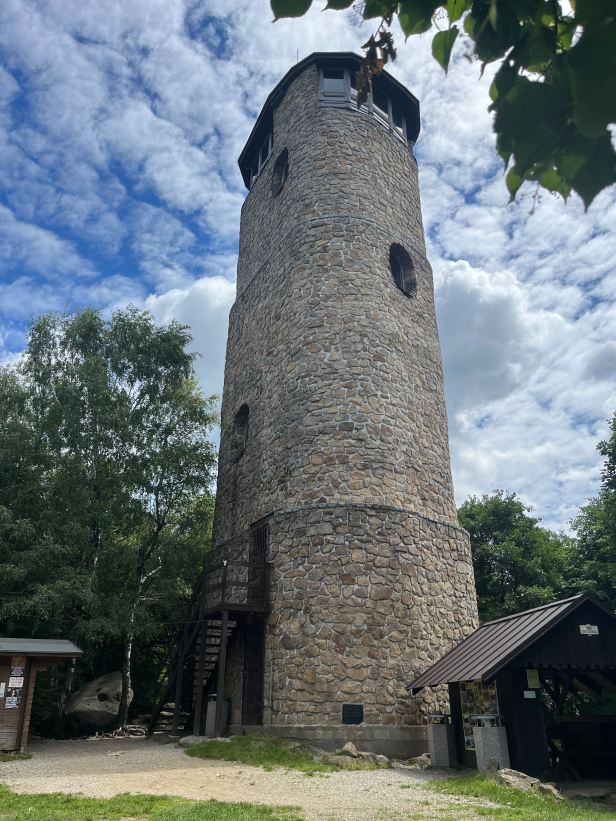
Inside, it has 99 steps and oak floors to the viewing platforms from which you can see as far as the Jeseníky, Beskydy and Vsetínské vrchy mountains. Of course, you will have to take my word on the last bit, because we did not see it. Because the public are idiots, who cannot be trusted, the tower was barred and we could not go in. It is apparently open at weekends and, presumably, on, New Year’s Eve.
We descended back to the track and wended our way along the crest. On our way up the slope, we had happened upon a concrete structure that a notice claimed was part of a highway that began to be constructed in 1936. I had never heard of this, but naturally, Lucie had. It was a fascinating tale that, although true, I found hard to believe.
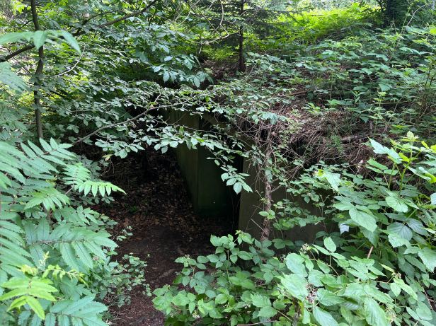
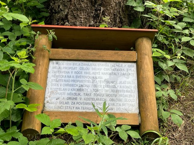
In the 1930s, the then Czechoslovakia was a wealthy country. It was also, thanks perhaps to the wobbly pencil of those who originally sketched out its borders following the collapse of the Austro-Hungarian empire in1918, quite a bit bigger than its post World War Two borders and incorporated parts of what is now the Western Ukraine. Anyway, a plan was made to join Prague to its far-Eastern borders and part of the proposed highway to do that, ran across these hills. The project called the Baťovy dálnice, continued, even during the Second World War, but was cancelled when the tide turned against the Germans in 1942.
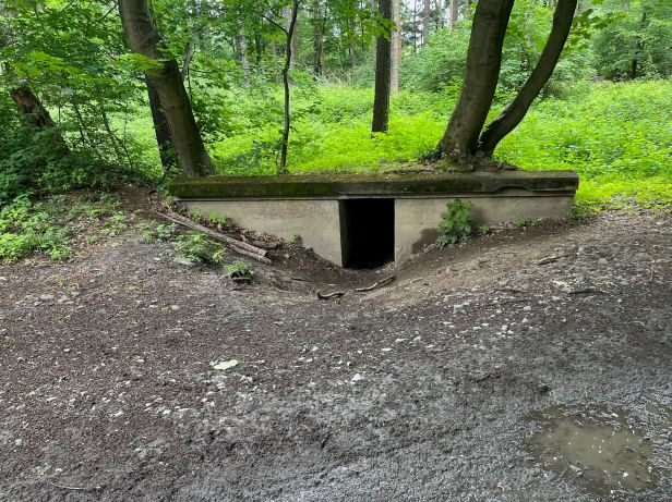
A little further on, we came across the foundations for a bridge on this highway. This is known as the Mostní pilíře Na Salárně (Bridge pillars at Salárna)
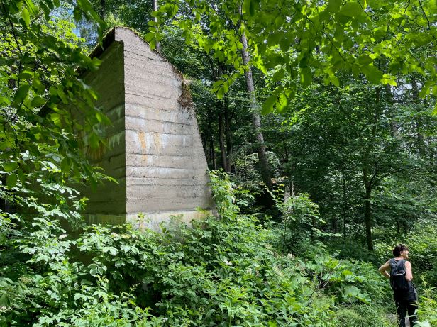

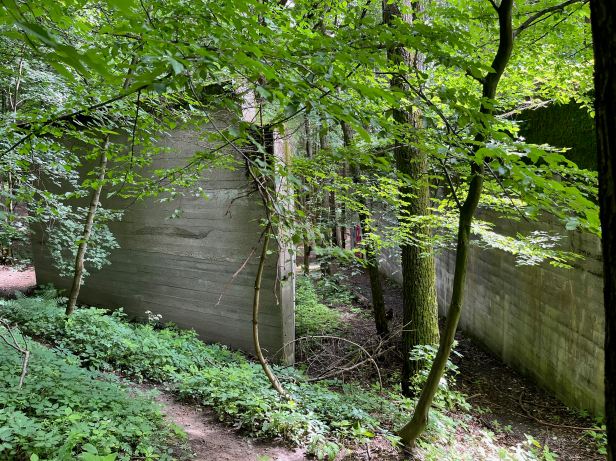
It was weird. On a wooded hillside (although the trees may not have been there then) in the middle of nowhere, were the makings of a bridge, Even after ninety years of neglect, the concrete appeared almost brand new, hinting at what must have been its initial superlative quality. We had seen the same super concrete at the Hanička Fortress in Northern Moravia, a few days before. Such a waste of time, effort and resources.
A little further on, we came upon yet more remnants of the highway. It seems that they are scattered all over the whole area.
We walked on and eventually came to Lucie’s second way point which, happily, was a pub and pension, the Restaurace Bunč (Roštín 287, Roštín).
We enjoyed a pleasant and fairly light lunch (if you can call Lucie’s Alpský knedlík (a dumpling filled with plums and covered in vanilla sauce) light) before striding off again. We later found out that, if the proposed highway had been completed, the Restaurace Bunč would have been demolished. As they say “Some you win ….“
As we walked away, the first thing we saw was another memorial to yet another group of partisans from the “Olga” brigade, that fell foul of the Wehrmacht, another twenty met their ends in the area during the war.
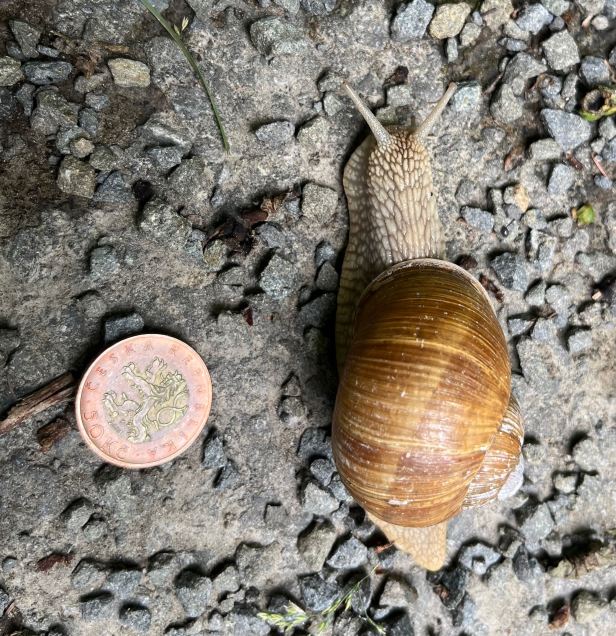
The road we were now on was metalled, but signs prohibited its general use without permission from the local Bishopric or the authorities in (far away) Olomouc. How odd. The area has a few rare species, one of which is the black and yellow Ještěrka živorodá (Viviparous lizard – zootoca vivipara). Almost unbelievably, considering the speed at which a lizard can move, we came upon one, squashed into the tarmac. Statistically, considering the restricted usage of the road, this was incredible. We debated as to whether the local Bishop had a Ferrari – or whether it was a Parish priest on a silent, but deadly, skateboard. We also saw some gigantic snails and Lucie marvelled at the variety of unusual wild flowers in the abundant local flora.
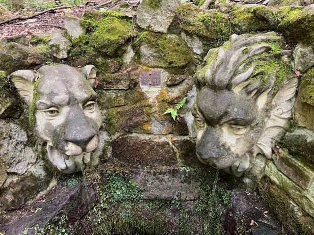
It was a fine, sunny afternoon as we strode purposefully onwards. We both love it when somebody just does something for other people, without expectation of recognition or reward. Beside the tiny road we found that someone had skilfully converted a natural spring into a, rather stylish, place that passers-by could get a drink of water. That was some good carving. The lions had glass eyes and were very realistic.
The path then led, seemingly endlessly, through the woods. The broad leaf woodlands are very different from their coniferous counterparts. They are often darker, because the leaf cover, high above, is different, but the forest floor is also different, because of all the dead leaves.
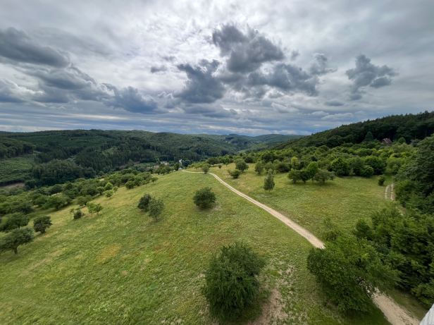
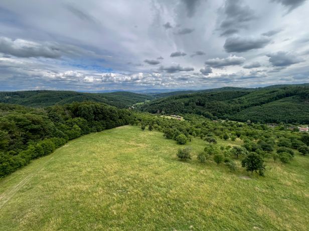
After a couple of slight missteps where we lost the path, we finally came down out of the woods and into the meadows. Here we found a second lookout tower.
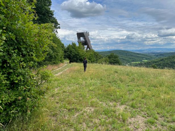
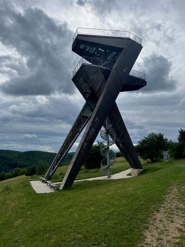 This was built, at the expense of a private benefactor and designed by Jan Smékal. The 21 metre tall structure, sits at 366 meters above sea level and represents a pair of interlinked (lucky) sevens and was built in 2015. It was an impressive structure, totally themed around the number seven. Even the 112 steps up were in groups of fourteen.
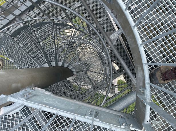
The views from the top were very impressive, but Lucie was not over enamoured by the mesh floors of the viewing platform that allowed an uninterrupted view of the ground, far below.
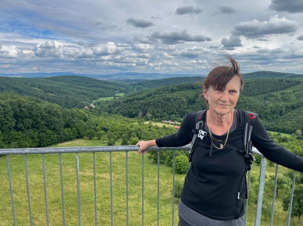
From the base of the tower it was a comparatively short walk down the hill and into Salas. I have to admit that we were both trudging slightly as it had been a taxing eighteen kilometre trek.
When we got back, we showered and rested up a bit. Then we went to the in-house restaurant for dinner – only to discover that they were, again, not cooking !
It is a lovely pension, but the website is a bit misleading !
The waitress did get me a (cold) pickled Hermelín cheese – but, for the second time on this short trip, Lucie was reduced to disconsolately nibbling breadsticks …..
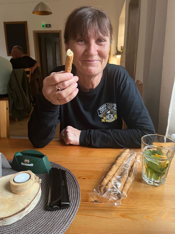
Amazingly, we did not die of hunger.
Then it was bedtime. After almost 30,000 steps, I was soon out like a light.
